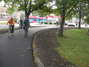
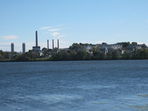
Showing posts with label urban. Show all posts

Wednesday, June 20, 2012

ToddlerLand Found

I found ToddlerLand in greater Boston! It has everything a toddler needs to have a fun filled morning.

Of course we begin with a train ride.

Then we find a big field to run and romp, and the many dogs are fun too.

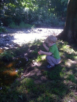
A brook to look at little fish and water bugs. However, toddlers probably shouldn't play in the brook since many dogs already do.


But do not fear when it is a hot day, there's a great splash pad at the top of the hill. And the playground has a sand box too.

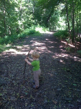
Wooded paths, where we can play with sticks.

Trails with waterfalls.

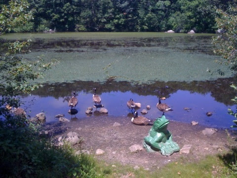
And a pond with ducks, geese and frog statues to top it off.

Where might this be, but Beaver Brook in Belmont. It's just a hop, skip and a jump from Waverly. Which you can get to by train from North Station or by bus from Harvard Square.

The southern historic section is the most easily accessible from Waverly, and where you will find most of the fun toddler activities. Once out of the train or bus stop, walk northwest along Trapello Road. About 200yds you'll reach the playground on your right, a little further on your left up Mill Street is Duck Pond and nice wooded trails.

If you are looking for more trail walking go to further north to the Rock Meadow section that extends into Waltham. If you need still more trails to walk along, just keep walking along the Western Greenway, walk to Belmont Center, downtown Waltham, or all the way around back to Waverly. But I digress, this degree of walking is mosty for older kids.

First just take your toddler out on the wooded trails and paths. Find sticks to bang against rocks, fish & bugs to watch, and dogs to pet. That is fun enough.


Saturday, April 14, 2012

Wayfinding Signage for Cyclists

Lately I've been working with the Somerville Bicycle Advisory Committee (SBC) to develop a few signed bike routes throughout the city. Ordinarily a City our size shouldn't need signed bike routes. Boston on the other hand is large enough to justify them, and is working on them.

Most of our direct routes require riding on rather busy streets. Often, these routes have lower traffic alternatives, often with better bicycling infrastructure. Except these alternative routes can be more complicated, thus signage would be helpful.

What I'm trying to figure out is what type of signage would work best in Somerville. Here are a few of the goals and constraints that we have:

  • Limited street space for large signs or kiosks, more space can sometimes be found at key landmarks, destinations and parks, but not always.
  • Limited funding available for signage, so every element of the system must count, and the ability to use existing sign posts and structures would be helpful.
  • A multi-lingual society, so the use of symbols is preferred where possible.
  • Dual use of signage for pedestrians is a preference if possible.

There are a few methods of developing a route that will impact how the signage functions and appears. We haven't made this decision, so it is important to consider these three different methods.

Method A Route Signage:

Though bike routes often have names, the signage for the route is almost always numbered. The signs are similar to what is used for highways. An examples of bicycle route signage is the Claire Saltonstall Bikeway from Boston to Provincetown, which is Bicycle Route 1 in Massachusetts. Incidentally it is the only numbered bicycle route in Massachusetts. The standard US bicycle route sign is shown below. These signs can be confusing, as they do not include route identification or destination information. Of course our highway signs do not include this information either, however highway maps are ubiquitous and are generally understood by all Americans (even those that do not drive).

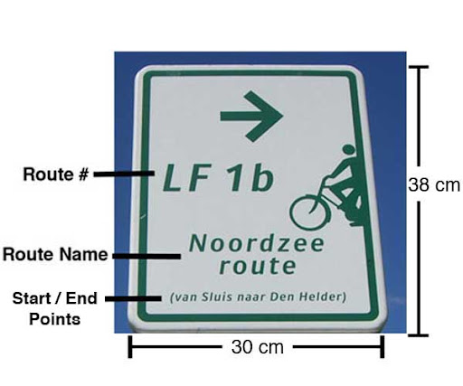
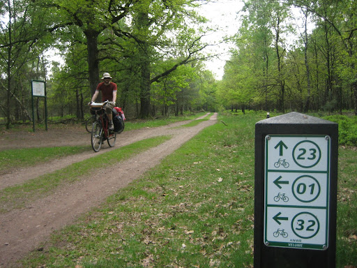
Another example is the Dutch LF Routes managed by the ANWB (the Dutch multi-modal equivalent of the AAA). Similar to the Claire Saltonstall Bikeway, LF routes are long distance bike routes. The signs are similar to the US sign, except they provide additional information, as shown below and described further here. Often these signs include the organization managing the route, typically the ANWB in Holland.

Method B Destination Signage:

Destination signage highlight the destination instead of the route. For motorists, they are typically found accompanying highway route signs, particularly at junctions. Destination signage for bicyclists are most commonly used in urban areas. Most cyclists in urban areas are going somewhere in particular, not traversing a specified route, thus destination signs are more useful. There are of course exceptions, such as the East Coast Greenway. NACTO has a great site describing various bicycle signage systems, primarily focussing on destination signage, but also some route signage. A Berkeley example of a destination sign:

The primary difficulty with destination signage is their size and expense. To accomodate the name of the destination in a legible size, the sign must be large, and thus more expensive than other bicycle wayfinding sign types. In an urban area where destinations are more important, maps less common, and visitors more common, destination signs will always be important. Though it would be nice if they could be limited to junctions and not required at every turn. A secondary concern is that they require both literacy and some understanding of a particular language, which all cyclists are not guaranteed to have.

Another type of destination sign that resolves some of the above concerns is the Czech system of mute blazes. Instead of using the names of the destinations the signs use symbols that represent the destinations. The size of these signs could be significantly smaller than destination name signs, thus easier to fit along the route. Of course, destination name signs would still be necessary at junctions and to help define the meaning of the symbols. In addition it is usually easier & quicker to interpret a pictoral symbol than it is to read a name. It may be easier for cyclists to recognize the symbolic signs while moving.

Method C Nodal Signage:

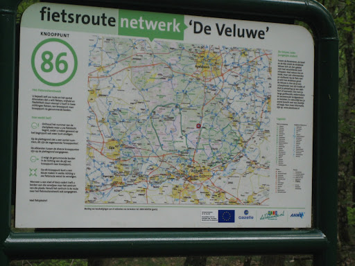
The third signage method is with nodes. This system originated in rural Belgium to aid bicycle navigation on the many country roads and paths. This system includes a dense network of designated bicycle routes, too many to number and name. Instead they number the intersections or nodes. Each stretch of bicycle route connects two nodes, and the signs direct the cyclist to the next node ahead.

It provides for a very flexible system that can accomodate point to point, loop, short and long rides. This system does require a map to navigate, yet maps are located at most nodes throughout the network.

This system allows for small numerical signs along the routes to provide direction. Yet the routes do not need to be point to point, which the standard route signage requires. It is more difficult to learn since it is not common here, though similar system are often used at cross-country ski and hiking areas.

The most likely candidate for wayfinding signs in Somerville is Destination Signage, if we can develop a more cost effective system that can fit along smaller streets. Maybe an innovative combination with Route or Nodal Signage may work. I welcome your thoughts and ideas.

Saturday, January 28, 2012

Towers Atop Boston

I figure most of us enjoy a good vantage point to observe the world, or at least over Boston.
To see a region altogether, a view up high is particularly helpful. I've found there are a number of such opportunities in the Boston area. What's more, they are fun to get to. Take Wright's Tower, as an example.
Starting in Medford Square (bus 94 or 96 from Davis), the walk into the Middlesex Fells is quite pleasant.  Through the nearby neighborhood, walk north to the Fells through; I recommend Ashcroft Road.
As you get closer to the Fells you will notice a rockier topography. At the end of the neighborhood you reach the Fells near Bellevue Pond. Follow the old Quarry Road to the too of Pine Hill and you will find Wright's Tower.
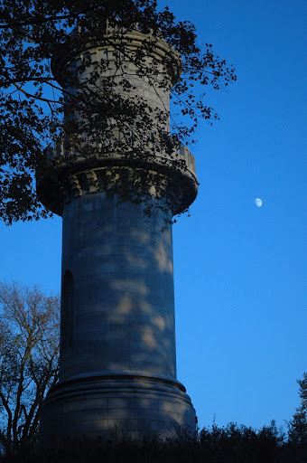
The tower is open year round during the day with a short climb to the top, which affords a distant view of the Boston skyline (opening image, above). In the other direction is a sweeping view of the Fells, appearing as if there were no further development from here to Mt. Wachusett on a clear day.
Closer to Boston we find Prospect Tower in Union Square, Somerville (87 from Lechmere & Davis). It is on the top of a rather steep hill to the north of the square. The view of Boston and Cambridge from the top is fabulous, but always wintry. 
Unfortunately, the City only opens the tower to the public on January 1st, during their celebration of the first American flag raising at this location. The celebration and the view are worth the mid winter trek.
Another great view of the city, which is open year round is everyone's favorite in Charlestown, the Bunker Hill Monument. Best arrived at by walking through the old Charlestown neighborhoods from the Community College Station. The 221-foot tall tower commemorates the Battle of Bunker Hill, and affords a good 294 step workout to get to the top. This effort is not wasted since it is the closest tower to the center of the City, which provides striking views of the City that you can't get further away.
Sadly, the viewing area is cramped with four very small windows with grates, which diminishes an otherwise spectacular view of the City.
Of course, I  saved my favorite tower for last.
May I introduce the The Washington Tower in the Mount Auburn Cemetery (71 or 73 from Harvard). The experience is nothing short of majestic. I find it best to walk aimlessly through the Cemetary. Walk somewhere you haven't walked before. Work your way to higher points, eventually you may find yourself at the foot of the tower. Proceed to the top, it is a good climb but not tiring.
Observe the world.

Saturday, October 22, 2011

Portland

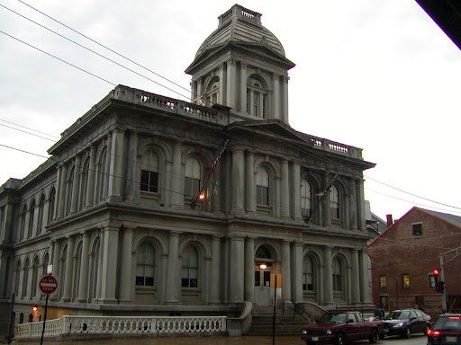
Portland, ME has become on of my more favorite nearby cities to visit. It is near and similar to Boston, yet the differences are striking.

Like Boston it was settled on a peninsula, unlike Boston they did not fill the surrounding harbors and bays. The city still feels like a peninsula with water surrounding three sides. The architecture is similar, but without the multiple high-rises. The streets are still narrow, and the traffic isn't overwhelming.

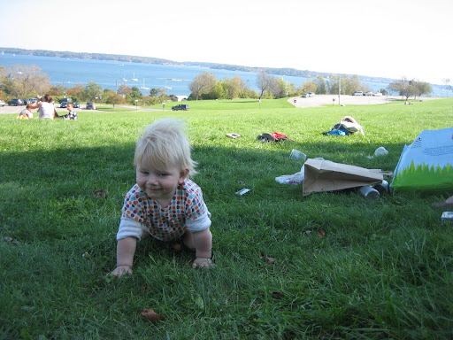
A couple weeks ago, my wife and I took our son to Portland, and one of the nicest things for him was the abundance of parks. There were many playgrounds, but the open space, fields, trees, ponds and hills alone were entertainment enough. Deering Oaks Park is particularly nice.

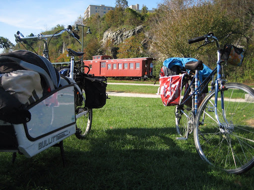
Our friends, Dorea & Angela, over at Carfree with Kids recommended the Eastern Promenade, above. They also noted that at the top of the hill is a great cafe and next to it is a little market where we also got lunch. This area is probably one of my favorites, with nice restaurants, beautiful old homes, the signal tower and an expansive view of the boats sailing across Casco Bay.

The promenade is near the top of a hill and it can be a long ride up to from the bike path, but well worth it. Speaking of bike paths, Portland has an ample supply. The back cove trail is nice with a crushed stone surface. Our favorite is the one along the bay just below the Eastern Promenade, it even has a narrow gauge tourist train, what more could one ask for?

The bike paths are primarily flat. The rest of the city is quite hilly. With modest traffic on a rather small peninsula with the abundant bike paths, cycling around the city remains a pleasure. Even the random cobble stone streets can be fun.

There is, of course, more to do than just bike around and go to parks. Here is a hand full of things we either did and would recommend, or would like to have time to have done ourselves:

  • The Standard Baking Company, down by the old port, by far the best bakery I've been to.
  • Portland Velocipede, a pleasant bike shop and they carry just about any urban utility bike that you may want, which includes a couple different bakfietsen!
  • Local 188, a fabulous dinner and even better drinks. I would recommend a reservation.
  • Children's Museum of Maine, we didn't get here but I've heard many good things.
  • Casco Bay Lines, which is the local ferry service. Of particular fun in Portland as there are so many islands that you could go visit.
  • Duck Fat Restaurant, after we returned I heard of this place and was sad that I missed it.

As for lodgings, we stayed at the Holiday Inn downtown. They had a small bike rack in the parking garage, which wasn't secure but was out of sight. It also had a door directly into the hotel and elevators making loading & unloading easy. The indoor pool was an added bonus.

The price was reasonable, and on the lower end for downtown lodgings. Some of the B&Bs are similar or less expensive. On past trips, we once stayed at the The Inn at St. John, which is inexpensive, quirky and a little far from the center of downtown. On another time we stayed at the The Percy Inn, which was a nice B&B on the border of the arts district and the west end neighborhoods, but a little far from the Old Port where most of the action is.

Portland is a fun place to be, and so is getting there from Boston. The Downeaster, an Amtrak train from Boston to Portland, is a great way to get there. The seats are comfortable, the conductors are helpful and the cafe car has decent food. For those, like us, wishing to take their bikes, well that is easy. The train has a large baggage car with bike racks, which we had used on a previous bike trip to Maine.

But this time we also had a cargo bike instead of two standard sized bikes. I knew it could fit in the baggage car, but I wasn't sure that would all work out. Luckily the train crew worked with us to get the baggage car open so we could get the two bikes in. Initially they wanted to put both bikes into the coach section; maybe they do not use the baggage car for bikes once summer has passed. Once in Portland the crew helped us get the bikes off the train, which would have been difficult to do it alone since the platform where the baggage car stops is 4' lower the car deck.

Worried that I would have to lift the bike back up the 4' when we left, asked the station agent for extra time to load. The agent requested that we load with business class. To our pleasure, they stopped the business class and baggage cars at the high section of the platform so we didn't have to lift the bikes.

I would definitely take large cargo bikes on the Downeaster again. Though I would definitely ask the Boston agent to let us board earlier.

Friday, December 10, 2010

Winter Please

Autumn has almost come and gone. Yet I do not despair, we are approaching one of my four favorite seasons.
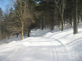
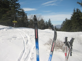


As usual, I have been planning some bummels & jaunts for the winter. And even more usual, I probably won't be able to do half of them.

Here are a handful of ski trips that I'm considering, most of them are T accessible. So, if you have an opportunity to try one out let me know, I'd like to hear your report.

Town of Lincoln
The Lincoln Land Conservation Trust has protected over 1000 acres in Lincoln and has over 50 miles of trails. Most of the trails are perfect for xc skiing. In fact there are more winter trails than summer trails, since wetland areas are frozen and passable with skis. And getting there is easy, take the Fitchburg commuter rail from North Station or Porter Sq Station to the Lincoln Station, train schedule. Trail maps are also available at Lincoln Town Offices; I bought mine at the Town Library.

Minuteman Trail
Our favorite urban bicycle trail is a great place to xc ski in the winter. A couple years ago I skied from Davis Sq to Arlington Center right after a storm. The Cambridge portion was already plowed, but the Somerville and Arlington section was great. Year round cycling has become more common and Arlington and Somerville plow their sections more frequently, so getting out soon after a storm is more important. I don't know whether Lexington and Bedford plow their sections, so you could take the 77 bus to Arlington Heights and ski into Lexington. The 76 and 62 busses will take you right into Lexington Center.

City Streets
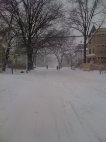


Or you can ski along city streets immediately after a storm. Saturday night storms are particularly good, since cities don't plow as regularly on Sundays.

Middlesex Fells
The Middlesex Fells is a good option after a storm, though walkers pack the trails fairly quickly. The fire roads are nice and wide. They do tend to be stoney, so you need 6-12" of snow, and still you might want to take a pair of rock skis. The Friends of the Fells provide a very good map of the Fells. The following bus routes get you into the Fells, 99 from Malden, and the 132 from Malden, another option is to take the commuter rail to Winchester and walk the half mile to the Fells.

The Blue Hills
The Blue Hills provide great terrain and is easily accessible from the city. Most of the wide trails on their map are good ski trails. The rangers have even developed a Ski Routes pamphlet. As for access, it seems that bus route 240 from the Ashmont station provides access right to the heart of the the Blue Hills.

Now I understand that setting your own tracks isn't everyone's cup of tea, so here are a few more options.

Weston Ski Track
The Weston Ski Track is the closest cross country ski center. They groom, set tracks and even blow snow. It is near the 128 & MassPike interchange in, of course, Weston. But what's better, it is near two rail stations. Riverside, the end of the D line, and Wellesley Farms, on the Framingham/Worcester line. Both stations are about a mile away, though the ski trails are a little closer to Riverside.

Great Brook Farm
I will also share my favorite local cross country ski center, even though it is not transit accessible. That is Great Brook. It is an old farm in DCR land in Carlisle, which I think is better than the Weston golf course. They have ski rentals, and a wide variety of trails; some of the hills are a bit of a challenge. They even have a night skiing loop lit with kerosene lamps!

If you read this far, you should probably learn that I'm not only a fan of cross country skiing, but I do enjoy downhill too. Here are a couple downhill alternatives.

Blue Hills
The Blue Hills, same ones mentioned above, also have a downhill ski area. It isn't really transit accessible, but it is close, especially if you live on the south side of the city. It might also be fun to take light backcountry skis, take the bus to the Blue Hills, and ski across the reservation to the downhill area.

Wachusett Mountain
This is another nearby DCR reservation. The roads in the reservation and to the top of the mountain are closed in the winter, which affords good cross country skiing. There is also a downhill ski area on the north side of the mountain. And of course, my favorite, they have a ski train!

I hope this whets your appetite for skiing this winter. If you make any of these jaunts, please let me know. I'm sure to share my own this winter.

Tuesday, November 2, 2010

A Mystic River Ramble

Every year the Somerville Bicycle Committee hosts the Tour de Somerville. This year's ride was so enjoyable that I figured it would make a fine urban jaunt in it's own right.

The route is almost entirely on separated bike paths from Davis Square to Alewife Brook, and following the Mystic River downstream to the Blessing of the Bay Boathouse in Ten Hills Village.


We began near the Davis Sq T Stn, you of course could start anywhere on the Somerville Community Path.

As you may notice, I'm in the photo with the microphone. Since I was helping lead the Tour, I must thank Doug Mink at masspaths.net for taking these photos and sharing them.

The beginning of the tour is fairly straightforward, going out the Linear and Minuteman Paths towards the Alewife T Stn. But once we pass into Arlington and under the Rte. 2 bridge it starts to get interesting. Just before the path veers left around the fenced in area, take a right turn into the neighborhood. You pass between some stone blocks onto Thorndike, which is a dirt road here. Immediately take another right onto a narrow, dirt trail.

In short order this trail will take you over to the new Alewife Brook Path. Heading left, downstream, on this path is pleasant. There are a few openings out to the brook. It isn't long before you reach Mass Ave. It is best here to take the right onto the sidewalk and cross Mass Ave at the intersection.

The path on the Cambridge/Somerville side of the Brook is next to Rte. 16, but the benefit is that it is paved. The Brook will have trails on both sides, the Arlington side being unpaved.

Since the paths are still under construction, the section between Woodstock Street and Broadway is not passable. It is best to ride through St. Paulson cemetery, easily accessed by crossing the little Woodstock St Bridge, and taking the next two right turns.

After crossing Broadway the route passes by a number of ball fields, a public DCR pool and Dilboy Field. The path here is already very well paved.


Next you cross the Mystic River Parkway. After crossing, going left will take you upstream along some existing paths to the Mystic Lakes. But we went right to continue downstream towards Medford. This section has very nice, large grass fields, but the could use some repaving. Luckily e DCR has a plan for improving this section.


Just after you cross under the railroad bridge, which will hopefully be the terminus of the proposed Green Line extension, you'll reach a bridge across the Mystic River. Here you want to cross Rte. 16 and the bridge. The path near the river is only a walking path in a grass field. A pleasant ride if you have wider tires.

The path soon is paved again and you pass the recently refurbished Medford band shell.


Continuing along the path you eventually have to cross Rte. 16 at a signaled cross walk. The path will take you to a crossing at Main Street, cross the bridge over the river and take an immediate right onto Clipership Drive. You are right next to Medford Center, so if you need to stop for a snack, now is the time.

Take the next right onto Riverside, at the light. Continue underneath I-93. Take your first right again into Park. A very short road, and across the road is a yacht club parking lot. Cross to the far end of the parking lot and ride along the grasses walkway to end up on another set of Mystic River paved paths.

Along this section you'll see Medford new wind turbine. Proceed along the path and cross over the river and under Rte.16.


And continue on the path that continues along the Somerville side of the Mystic.


This path has some unique views with a mixture of wilderness and the city.


From Riverside this is one of the longest sections of path without any street crossings that I know. That path ends at the Blessing of the Bay Boathouse, where we had refreshments provided by RedBones.


Unfortunately, Red Bones won't be there when you ride by. So you should just join us on next years Tour de Somerville.

Now I know that this route can be difficult to follow. It could really use some signage. But in the meantime here is a map that should help!


View B&J Mystic River Ramble in a larger map


Friday, August 13, 2010

Island Ferries

I grew up on the Gulf of Mexico, and was regularly out on the water. Every so often I get the hankering to return to the water. Luckily, Boston is a great city to satisfy that hankering, even if you don't own a boat.

The other week we met a few friends down at Long Wharf, near the Christopher Columbus park. From there we picked up the ferry and left the city behind.


Past Castle Island.


To arrive at Spectacle Island.


Where we walked up the trail to the gazebo in the saddle between the two drumlins. We ate lunch with a view of sail boats and Long Island in the distance.


The island has a number of nice walking trails and great views from the top of the two drumlins. Next time, I would like to take a picnic up to the top.


The island has a nice dock for ferry and private boats. The visitor center is modern and has a restaurant. There is even a beach, which is was crowded by the time we left.


After walking off our lunch, we headed down to the dock to catch the inter-island ferry to Georges Island.


Fort Warren is a fun place to explore.


After more exploring and another snack it was time to head home. We had a pleasant trip, but every jaunt must come to an end. I was getting a little sunburned anyway.

The Islands are particularly easy to get out to. All you have to do is get downtown. Most take the T, walk or ride a bike. If you drive may I recommend parking at Post Office Sqr, their weekend rates are more reasonable and the walk isn't too far.
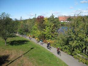
The ferry dock is on Long Wharf, adjacent to Christopher Columbus Park (not on the Aquarium side). The line for the ferry can be quite long, it was for us. I would recommend buying tickets the day before online, especially if the weather looks good.

For more information, I strongly recommend the Boston Harbor Islands website. They have ferry schedule information, tickets, island activities, and probably a lot more.

So don't forget your lunch (though Summer Shack has a restaurant on both islands), sunglasses will help, lots a water and sunblock. And if you like the islands more than you expected, next time reserve a campsite and stay the whole weekend.