Showing posts with label sporting. Show all posts

Saturday, August 23, 2014

Tales from the Dirigo

 
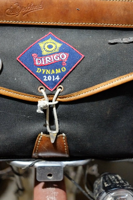
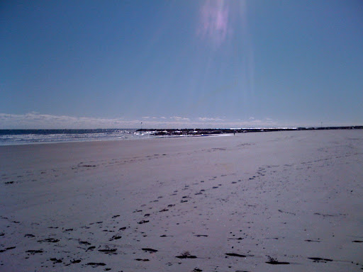
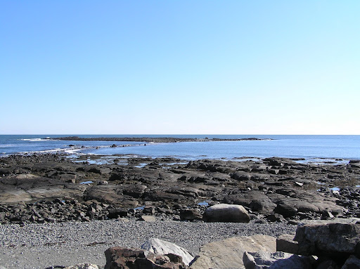
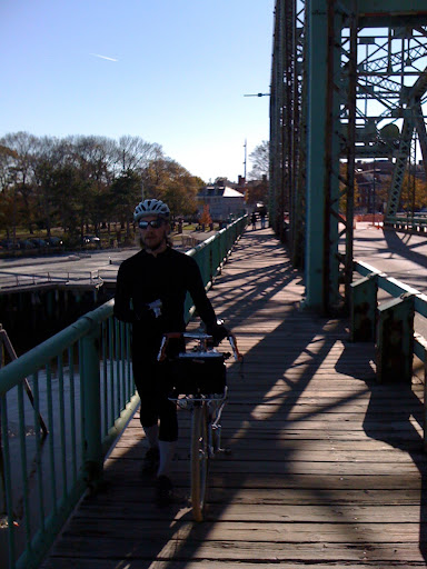
Earlier this year was our second Dirigo Dynamo, an overnight bike ride from Boston to see the sunrise at Old Orchard Beach. The route starts in Somerville heads north through Massachusetts and the New Hampshire coast, arriving in Portsmouth around midnight. We proceed through Maine, following the well-signed Eastern Trail. Most of us return by train from Portland on the Downeaster. A couple ride reports follow:

2012 Dirigo Dynamo by Lovely Bicycle!

2014 Dirigo Dynamo at Yurtville.

Dirigo Dynamo Photos on FlickR.

If you are interested in the Dirigo Dynamo, chances are we will ride again summer 2016. We are are tentatively organizing an odd year Dynamo to Provincetown. We will probably watch sunrise on the beach in Wellfleet. Return could be by either by ferry (BHC or BSC) from Provincetown, or Cape Cod Flyer from Hyannis. If you are interested in joining us, comment below.


Monday, November 21, 2011

200km to Portland & Return by Train

The plan: a beautiful fall ride along the New England coast from Boston to Portland, then catch the evening Amtrak Downeaster back to Boston.

The reality: we made it to Saco, fifteen miles short of Portland, where we encountered a huge Amtrak fail.

Jon and I wanted to get one last long ride under our belt before the winter restricted us to commuting and the short west Boston jaunt during the rare warm winter weekend. To further encourage us, the leaves were turning a little late this year, so there was still a little color left in early November, especially along the coast.

I knew that I would need all day to ride the 200km (120 miles) to Portland, so we met at my place before dawn for coffee and bagels. With lights running we headed north through Medford and Malden. By the time we hit Saugus the sun was up and time to switch our lights off.

Though rather direct, the route from Somerville to Peabody involves many turns making navigation a challenge. Once we arrived in Hamilton we rode on Route 1A much of the way to Saco. The ease of navigation here allowed us to spend more time enjoying the ride and the views. I believe our favorite section was the farming land and salt grass lands between Ipswich and Newburyport.

North of the Merrimac River our route was the coastal road all the way to Portsmouth. This stretch was largely uninterrupted coastal vistas. The southern portion is mostly large expanses of sandy beaches.

Further north the coast becomes rockier and thus hillier. But we were still fairly fresh, and the views were very worth it. If we lost any time on this section it was because the temptation to admire the views was too great.

We pulled into Portsmouth about 1pm, just over six hours on the road. We found a good sandwich shop and ate them in the square. The day had become quite warm, and there were people everywhere outsode enjoying the day. Following lunch we headed north once again, this time to cross the Piscataqua River into Maine. The old downtown Rt 1 bridge is closed to automobiles, but you may still walk your bike across.

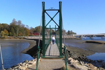
The portion in Maine was more wooded and the leaves had turned less. The roads were a little hillier, but still quite comfortable. While passing through York we found this great pedestrian bridge that we stopped to cross, and it provided a nice place for a snack.

Before we knew it we had arrived in Ogunquit. The traffic was heavier; more so as we reached Rt. 1. We decided turn inland towards back roads instead of riding on the busy road. The hills became more difficult, primarily because I was tiring. At least it afforded us the luxury of riding on a portion of the Eastern Trail, which was a true luxury. Aside from a few blow downs, the stone dust path was a pleasure to ride upon. The sun had just set, so we enjoyed the quite darkness without worrying about motorists.

This section of the Eastern Trail ends in Biddeford - there is another good section near Old Orchard Beach that I had ridden before. By the time we arrived in Biddeford it was getting too late to push on to Portland and still catch the 7:55pm train back to Boston. Knowing that there was a stop in Biddeford/Saco, we decided it was most prudent to have dinner and catch the train here.

This proved to be a great idea, until the train arrived and the conductor wouldn't allow us to bring our bikes on! I'd never caught the train in Saco, but I'd done so at Portland and Wells by bike without any trouble, indeed the past times worked very well. When we decided to cut the ride short at Saco I couldn't have imagined that Amtrak would not allow us on the train. Why would Saco be any different?

The only real difference is that Amtrak says so. Yet they don't say on their online schedule. Afterwards I found the fine print under the reservations & tickets page. They also display this bike caveat on their printed schedule, but they are only available at the stations, which wouldn't have helped us here.

So that every one knows, the Amtrak Downeaster only accepts bikes at Boston, Wells and Portland. I won't let this end my bike/train trips on the Downeaster, but it sure limits my ability to do so. it is a shame with the Eastern Trail passing through Saco/Biddeford and the Rockingham Trail near the Durham, NH station.

The route north was fairly straightforward, go north on the through road closest to the Ocean. To make it even easier I used Google Maps and selected the bike routing option, which provided a very good route. We also saw that this route is also arrowed from Ipswich, MA to Ogunquit, ME, and probably beyond. I can't recall the arrow, it was two letters. Does anyone know who arrowed the route and what the full route is?

View Larger Map

The only thing I would do differently next time would be to continue north along the coast through Kennbunk or Kennebunkport, instead of going inland. This may also save a little time and allow me to get to Portland without missing the train.

If you made it this far, I would like to share a short dream. This is a great route at a good length to ride north leaving just before sunset. The goal would be to reach Old Orchard Beach for the sunrise, have breakfast and continue on to Portland to catch the train home. A Boston version of the Dunwich Dynamo. We could call it the Dirigio Dynamo. Anyone in?

Wednesday, November 10, 2010

Bikecamping in Otter River State Forest

I'm always on the lookout for quality (quiet, low traffic) campgrounds within cycling distance of Greater Boston*; ones that fall into a 60–100mi away sweet-spot, avoiding highly trafficked areas. Recently when looking at the sacred, out of print Rubel Central Massachusetts Bike Map, I noticed Otter River State Forest's campground in Baldwinville, MA. The DCR website's description was enticing and with weekend lows dipping to 30ºF, all the better.


After a delicious breakfast at Sofra in Cambridge, the journey began as I headed to the Minuteman Bikeway in Arlington and met a friend who would join me. From the Minuteman's end in Bedford we followed the Boston Brevet Series 100k route to Sterling, MA. The route navigated us for about half of the outbound and inbound trip, a very handy resource indeed. Along the way we passed through the Apple Country (hilly areas near 495) where fall foliage was in effect. I'd say it's no secret to cyclists in the area that this is where it's at, anytime of year.


We arrived in Sterling around lunch time, ready to refuel after 40mi of riding. There's a few places to get food in town, including a pizza place. My buddy and I sat on a bench in front of the town library and scarfed a pizza down, then restocked ourselves with food and beverages in the nearby minimart. I was astounded by the minimart's quality beer selection, and couldn't leave without adding a 6-pack of Wachusett Oktoberfest to my panniers. I had packed light (up to this point), so why not indulge a little?


The Boston Brevet Series 100k route does a 180 in Sterling, so I put away the cue sheet and navigated using the Rubel Central Massachusetts Bike Map. This was easy, as there are not very many roads in this part of the state, so even a directionally-challenged person like myself could do okay. The numbered routes (62 and 68) were fairly comfortable for cyclists, so we stuck with them and enjoyed the rolling hills.


The scenery was standard for this stretch of the trip: trees, the occasional pond, etc. But once we got close to Templeton it became more interesting. While pedaling up an incline on Baldwinville Road a massive wind turbine began to emerge from behind the trees atop the hill. With the sun low in the sky, it truly was an awesome sight. We stopped at the highschool near the structure's base to gaze at the giant, remarking how quiet it was. I don't think even a hum could be heard.


Going through Templeton was noteworthy, too. Again, the sunlight was waning and the town looked the part of Exemplary Autumn in New England Town. Near the town's center we passed a ridiculously decorated restaurant/antique shop called Country Mischief and I made a note to check it out in the morning on our return trip.


We made it into the campground just as the sun set and it started to get chilly. There were more people in the campground than expected, but it was a big place and we chose a site that was secluded. It was a great site, situated next to a little stream that provided a white noise background, making it seem as if we really were the only campers. I setup my Hennessy Hammock near the stream, and we got to work building a fire. It had recently rained, so getting it going was a challenge despite the kiln-dried logs. But we eventually got a fire going and didn't stray far from it, as it was now frigid.


For dinner, I ate envelope-packaged tuna curry meals with pre-cooked brown rice from Trader Joe's. Both were new to me and worked out well. I'm a big fan of the envelope packs because they're tidy; you can heat and eat them right from the packs! Dessert consisted of chocolate-covered peanut butter pretzels and finishing off the remaining Oktoberfest beers. The feast concluded with nodding off by the fire and enjoying a clear starry sky.


The next morning was still frigid, and we struggled to remove ourselves from the fire's warmth. We finally did, packed up, and backtracked on familiar roads. When we arrived at Country Mischief the joint was abuzz, so we browsed the abutting antique shop while waiting for a table. The staff brought coffee/tea during the wait; it was pleasant as far as waits go. When we did get around to eating it was excellent. I had a veggie Eggs Benedict with incredible Hollandaise sauce; this is certainly why there was a line to get into this little place in the sticks!


The riding on our return trip was similar to the previous day's; maybe even better—it seemed sunnier. After passing through Sterling and reconnecting with the BBS 100k route the scenery and roads went up another pleasurable notch; my favorite spot in particular being Prospect Hill Road in Harvard, MA (site of the Fruitlands Museum).


Not much occurred on my last few miles home; though i did see an unusually large posse of turkeys near Hanscom Field. Why do I always seem to see turkeys when cycling? I made it home with a couple hours to spare before sunset, and not totally exhausted as the day's pace was comfortable and fueled with fine Hollandaise.


I rate this little trip highly; I'll surely re-visit it in the near future. To add some variety to future versions, I would probably still use the BBS 100k route, but connect the backroads between Sterling and Baldwinville in a more adventurous fashion. Also, not far from the Otter River State Forest is the Federated Womens Club State Forest, which looks most attractive to me with its primitive-style camping. The trick is, to camp there, one must go to Otter River for a pass, as there are no posted park staff in FWCSF. This ads maybe 15-20mi to the day. When the days get longer again, I think that's just what I'll do.

*This cycling distance from Greater Boston to Otter River State Forest, about 80mi, could be reduced by using the MBTA's Commuter Rail service to either Worcester or Fitchburg (I prefer cycling out of Fitchburg). Doing so will alter the route to Otter River SF, but that's okay because it's a great option. In fact, maybe this is what I should do when I go to Federated Womens Club SF!


Saturday, June 5, 2010

Estabrook Woods

I've always been fond of dirt road ridding. I enjoy the slightly more difficult terrain, but can still comfortably ride my road bike with plump tires. The reduced car traffic, and the rural and wooded scenery are definite plusses.

Over the winter I heard about two old roads in Estabrook woods on the border of Concord and Carlisle, between Concord Road and Monument Street. Estabrook Road and Two Rod Road are both old farm roads that run north to south. Some of my research suggests Estabrook Road was one of the main roads leading to the Old North Bridge.

I have always found the ride from Somerville out to North Bridge pleasant. I typically take the Minuteman Trail out to Bedford. At the end of the trail, continue on Railroad Ave. Just as the road turns right, continue straight into the dirt parking lot. From here begins the Reformatory Branch Trail, which is an unpaved rail-trail that continues into Concord.

The trail is mostly smooth and double track, though a little narrow to ride side by side. My Raleigh 3-speed moves along the trail just fine. But, of course, some parts get narrow and obstructions are not uncommon.


This is a pretty heavily used trail, so obstructions usually don't last that long. In fact, this tree was gone a couple weeks latter.

The trail is not just woodland. It also passes through a couple wilderness parks, such as the Great Meadows Wildlife Refuge, which is a favorite spot for birders. In particular, I like the agricultural fields along the trail.


And we wouldn't be in Concord if we didn't have a historic plaque. This one is along the Reformatory Branch Trail, which must have been a normal road in colonial days.


As you can see, the fields are no more, but North Bridge isn't too far away. Just take a right when you get to the next road, and you'll see the North Bridge to your left shortly.

A nice, well graded trail heads down to the bridge. On the far side of the bridge there is a nice view across the field to the river. The bridge is often crowded later in the day, so be prepared to walk your bike. Often there is someone in colonial dress describing the history of the bridge.


At the end of the trail continue right on the country road. Take your second right on to Estabrook Road, a lovely pastoral way with horse farms on either side. Shortly the pavement will end in a well graded dirt road with a stone wall and barn to the left.


Soon the farmland becomes woodland, take the left (straight becomes very rough and hilly). The road through the woods is only a little rougher, so go a little slower, especially around others hiking along the road. And say Hi, most are very friendly when walking through the woods.


Eventually you will leave the woods and enter a wooded neighborhood. Continue along taking right turns as they present themselves. When you hit Stearns Road, go left. Just as the Stearns Road turns left again, you will see a dirt road to the right. This is Two Rod Road.


This road is more like a trail and continues back to Monument Street. It is more rough, but taken slowly a 3-speed can make it just fine. The slower trail, which will require some walking from time to time, will allow you to spend a little more time to enjoy the woods. Towards the end of the road you will reach a wonderful little pond to take a snack and ponder.


The remainder of the trail to Monument Road is smooth and easy. Take a right on Monument Street. For those who like fresh produce, Hutchinson's Farm will be on the left. Soon you will pass North Bridge on the right. Then take the left onto the Reformatory Branch Trail to return to the Minuteman Trail and Somerville. For those who like maps, here is our track:


View Estabrook Woods in a larger map

Sunday, August 16, 2009

Deerfield DirtRoad Randonee (aka D2R2)

For a second year I gave it a go and entered the 100km D2R2 in Western Mass. As with last year, it did not disappoint. It was hot this year (mid 80s, some said 90s, I don't usually carry a thermometer so I'm not sure), and I hadn't trained nearly as much as last year, but I took my time, met some great fellow riders and had a blast.
All ready to go at camp. We camped the night before and after. Luckily this year we were a long way from the registration tent, with its accompanying lights and generators, so we could sleep through the first group that left earlier to cycle the 200km route.
Though I may have been ready, Jon & Scott were desperately trying to figure out how to pump up Jon's tires...
Scott's ready to go. Both Scott & Jon have Long Haul Truckers. I gather more D2R2 cyclists ride Long Haul Truckers than any other bike.
The rid follows winding roads through the attractive farms of Western Mass. Why are barns so often painted red? I think because it looks good against the green fields.
The first checkpoint was at the Little Big House Museum, or was it the Big Little House?Jon & Scott said the door is 10' high, imagine the window sill being higher than you. Unfortunately I didn't have the energy to walk over and check it out. In a randonnée, you have an overall time limit for the ride. You check in at various checkpoints along the route, and you must reach each checkpoint within a certain time. I was almost late, and since I was always left behind I wanted to rest up and move. No time to consider out-of-proportion buildings.
Back on the road again. Jon & Scott haven't dropped me yet. I can usually keep up on the down hills. So here is a great photo of Jon.
Some beautiful views on the ride. The views are best leaving the first checkpoint. And they are mostly down hill, which helps with the sightseeing.
I hit the state line near the end of the long climb on the second stage. Jon & Scott had already dropped me, but I fell in and out of other groups. There was a lot of leap frogging with other cyclists taking rests. Rests going up hill are nice, especially in the shade with a nice view. I could catch my breath and respond to the "nice fenders, did you make them" compliments. The "is that a single speed" question is too tough to answer going up hill, but on the down hills I would acknowledge that it was a 3-speed hub gear. Most understood, but many were still perplexed.
There were many dirt roads before this shot. But this was my first photo of a dirt road. Most weren't this well graded.
Here's an old road cut for Maggie.
The welcome site of the Green River covered bridge. This means half of the 64 miles and 3/5 ths of the 7800' of climbing were behind me. Oh, and we got to dip our feet in the water and wash our faces. But chatting with new friends was the best. It seems most D2R2 cyclists are quite nice, at least those running toward the rear like me.
It was near this house that I found a very slow leak in my rear tire. I was tired and performed the most lazy tube change: I found a nice lawn in the shade, grabbed my tools, sat down with my bike, and didn't stand back up till the change was complete. Oh, I even had some water and a snack, and contemplated a nap, but got up and continued to the third checkpoint. I didn't stop at the third checkpoint long, since I was running late. But, I did grab a couple of peaches and an apple from Apex Orchards, who host this checkpoint. Some of the best produce around.
Well, this is the last farm on the ride, and it is my favorite. You ride down into this beautiful secluded valley with hay fields running forever with a simple red barn and dairy cows grazing. But all good rides come to an end, and so must this.
Well, we've returned to the Deerfield farm that hosts the ride, you can see the tents set up in the background. I was shocked when I noticed that they are growing what appears to be tulip & daffodil bulbs! It reminded me of the bulb fields that Maggie & I saw last spring in Holland. It made me smile.

From D2R2
My green Fuji got me through another D2R2. As I walked into the Registration tent for a soda Jon & Scott walked up, nicely waiting for me to show before going to dinner. I had to ask how long they were waiting. Scott said 15 minutes, he must have been delusional and exhausted after such a tiring ride, because I knew they must have been further ahead. Jon agreed that it was closer to 45 minutes, but I bet it was longer because I took my time on the last two stages.

To give you a sense of where the ride was and the type of terrain see the following map. The satalite ("Sat") is fun, because you can see where the farms are. Last year I really liked the pastoral farmlands. This year the pastoral and fields were places where I had no shade.


View D2R2 100km Route in a larger map

Though not a charity ride, the D2R2 does support the Franklin Land Trust, which is a famland and open space preservation organization in Western Mass. They are a great organization to support, since they help keep the farm lands we ride through productive. Red barns neglected or condo-converted wouldn't be nearly as exciting to ride by. And the Land Trust finds many local land owners to support the ride, especially at the check points.

The ride is usually held mid August, and they host camping on Friday and Saturday nights. Of course you can drive out in the morning before the ride, but it is a blast meeting up with friends and fellow cyclists on Friday night at the camp.

There are three ride options, a 170km route with - too much climbing for me, a 100km route - which is just right, and a flatter 50km ride along the Green River. The Land Trust website has a good amount of information from this and past rides, and they will surely have a registration link in the spring for next year's ride.


http://www.franklinlandtrust.org/randonee.htm