Saturday, May 12, 2012
Camp Boston
Boston Harbor Islands (DCR & NPS)
The closest and most iconic Boston camping destination, and possibly even the easiest. There are three different islands you could camp on, ranging from old forts to secluded wilderness. Peddocks Island will soon be offering tent and yurt camping too. The islands are beautiful, with unique views of Boston, and often a lot of rabbits. For being so close to the city, they are also very remote, no water or electricity, and you can only get there by ferry, water taxi or private boat.
To go, pack light or pack in a rolling device and take the T to the Aquarium stop. The ferry dock is adjacent to the Christopher Columbus Park (not next to the aquarium). The ferry goes to George's Island (no camping) where you catch a second ferry to your particular island. You will need to be able to carry all your stuff in one trip to get on and off the ferries. Of particular note due to its remote nature, campers have to bring your own water, and carry of all of their trash.
Wompatuck (DCR)
Wompatuck State Park is on the South Shore and I don't know much about it, however it is large and I understand it has many good bike trails & roads. There is also the adjacent Weir River Farm and Whitney Thayer Woods, not to mention the nearby Worlds End Reservation; all are places I've been wanting to visit and haven't. It might be a great bike camp destination by taking the ferry from the Acquarium dock to Hingham and cycling the six miles to the campground, or take the train from South Station to Nantasket Junction for a four mile ride.
Ponkapoag Camp (AMC)
The AMC is well known for their White Mountain lodges and camps, but they are based in Boston and have a camp in our own backyard Blue Hills. It is very much geared to families. Reservations are focused towards week long stays, though I believe you can reserve a weekend. They have both tent areas and cabins. And for the parent that can't take the full week off, it is close enough to the city where you could still commute. It probably isn't best to cycle there, but a combination of the red line and Bus #240, and three mile walk on trails through the Blue Hills.
Camp Acton (Town of Acton)
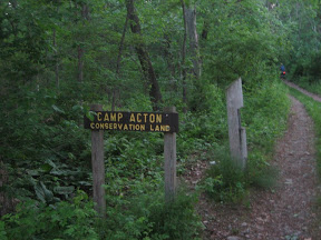
Off of Acton's Pope Rd across from a few farms is a dirt road that ascends to a trail leading to a dozen distantly separated campsite in a small forest of large pine trees. This is a secluded place to legally camp that few know about. It is a great destination for bike camping, it is only 20 miles from the city, much of which is on the Minuteman Bikeway and the Reformatory Branch Trail. The trail is also wide enough to easily bring your loaded bike into the campsite. It is also right on the Bay Circuit Trail and one could easily walk with a pack the four miles from the Concord train station
Harold Parker State Forest (DCR)
On the border of Andover and North Reading is this large state forest with a campground. It has mostly wooded with many lakes and walking trails. It is also 20 miles from the city, however the route is on busier streets. It is also on the Bay Circuit Trail and can be reached by foot from either the Ballardvale or Andover train stations with a 6 mile walk.
Winter Island (City of Salem)
A city beach and campground on the northeast tip of Salem. I know next to nothing about this destination, though Salem is a fun city to visit, with many museums, a nice downtown and a set of bike paths that go to the nearby quaint village and New Englang sailing mecca, Marblehead. Winter Island is also 20 miles from the city, though the roads in this direction are particularly unfriendly to cyclists (at least while the Northern Strand is not yet complete). Taking the Salem Ferry LINK or the train to the Salem station would be a good alternative with or without a bike.
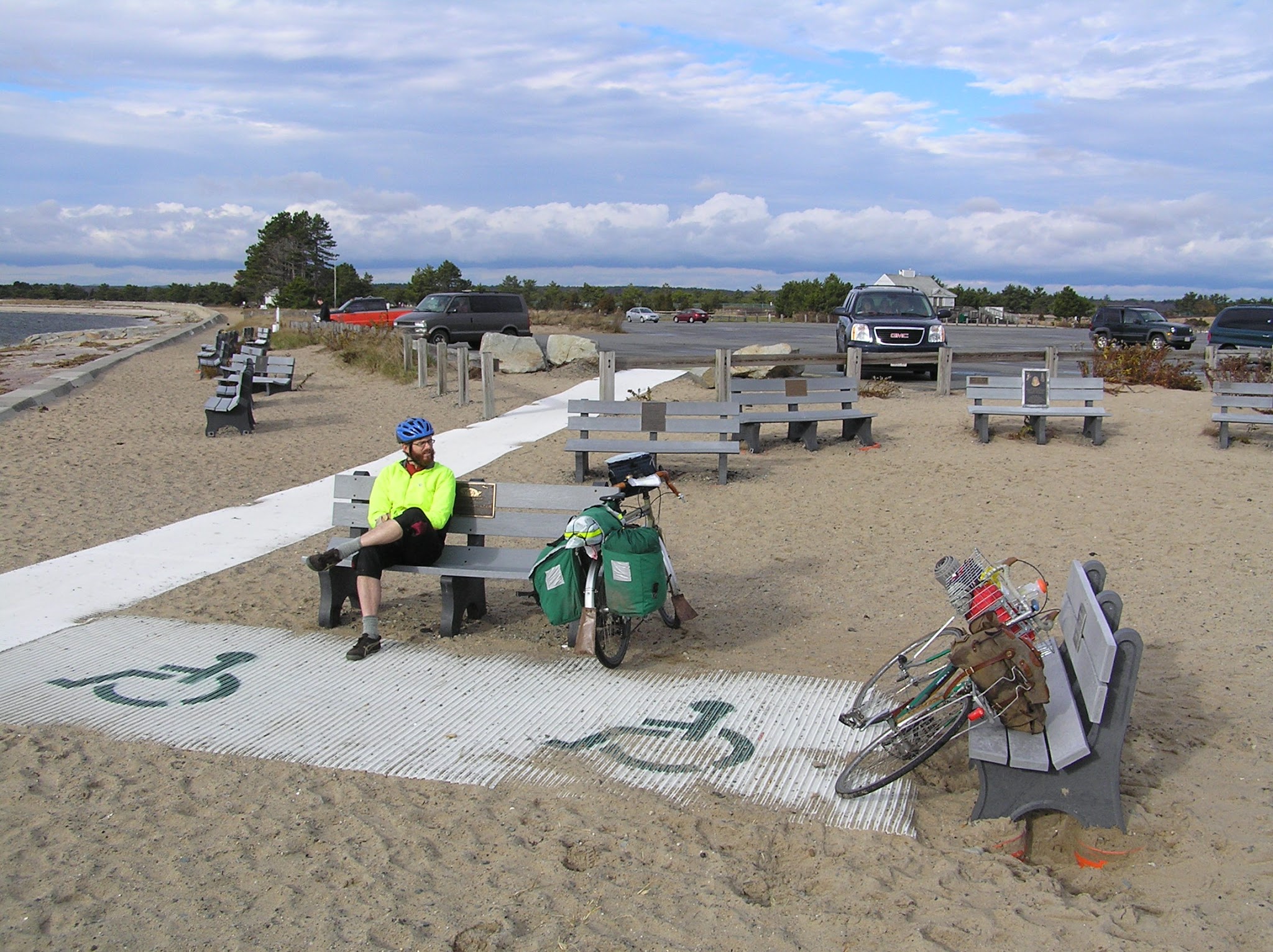
Of course, there are plenty more campgrounds nearby, and further a field on the Cape, in Maine, and further, including Salisbury Beach, shown above. The following map collects many, and hopefully more as I learn them.
View Bike Camping Nearby in a larger map
Saturday, June 11, 2011
Camping in Acton


I've been looking for a few good camping trips within a short bike ride from Boston. One that I found is a small municipal camping area in the northeast corner of Acton.
My friend Jon, who is better known for his longer bike camping trips, joined me on this short trip. We set out on this trip as a S24O or Sub 24 hour Overnight, popularized by Rivendell Bicycles. We left around 6pm Friday, and we were home by noon Saturday.
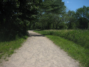
Camp Acton isn't too far away, about 20 miles. There are many ways to get there. My favorite route, especially when loaded with camping gear, is the Minuteman since it is along an old rail bed, and is thus flatter than many of the onroad alternatives. We also used sections of the Reformatory Branch Trail and we rode the length of the Battle Road on our return.


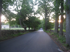
No matter how you decide to get out of town, the route through Concord will take you along many pleasant country roads, with names such as Barrett's Mill, Strawberry Hill, Pope, Spencer Brook and Westford Roads.


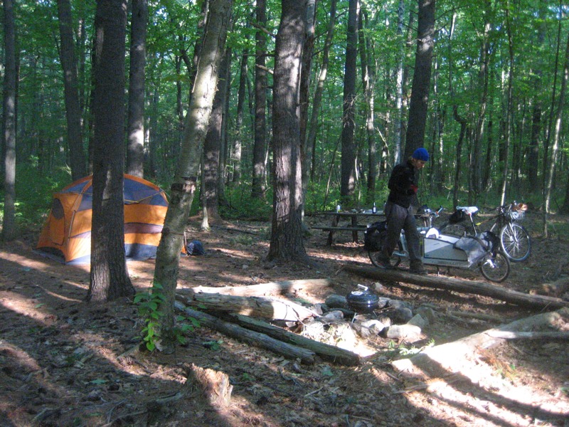
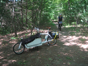
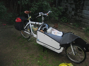
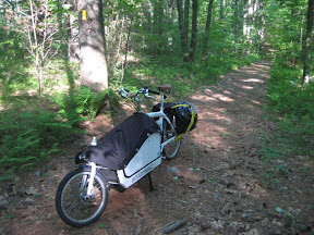
I would ordinarily take my road bike with panniers, or maybe just a saddle bag on a short overnight bike camping trip. However, I am recently a happy owner of a cargo bike, and I wanted to see how it would work as a touring & camping bike. This also gave us the opportunity to bring my luxurious four person tent and a charcoal grill!

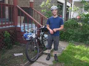
Jon, instead, took the minimalist approach. Yet he was nice enough to ride a single speed so I could keep up.

No matter which extreme of bikes, or more likely somewhere in between, you'll be able to carry what you need for a short overnight. Remember, you will not be too far from civilization (or home) so you can skip the excessive gear. You could even skip the food altogether and eat at a nearby restaurant.

Getting permission to camp at Camp Acton was much easier than I anticipated. In fact it is very simple, fill out this PDF with your name, contact, fellow campers and date(s) you would like to camp. Then mail the completed PDF with a $15 per night night fee to:
Acton Recreation
Town of Acton
472 Main Street
Acton, MA 01720
I would recommend sending it a couple weeks before you plan to go. If you are feeling uncertain, as I did, you can call Acton Recreation at (978) 929-6640. A very friendly lady named Cheryl helped me through the process and emailed me my permit once it was a approved.
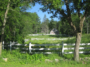
Of course you also need to select one of the seven campsites, and they are all good. The camp is in a large pine forest, so the ground is comfortable to sleep on covered in a thick mat of pine needles. Plenty of space between trees to set up even the largest of tents, and good tree placement if you prefer sleeping in a hammock. And each site has a picnic table and a large fire ring.
The mosquitoes were quite difficult at dusk and dawn; we ended up breaking camp quickly in the morning and eating breakfast at the North Bridge. Another friend lives nearby and notes that the mosquitoes are more tolerable later in July and August when it is drier. We went in early June and it was still quite damp.
The camp used to be an old Boy Scout campground, and is still used by scouts from time to time. The two sites closest to the road and small parking lot are very large intended for groups. We stayed at the seventh site, thinking it would be the most secluded, which it was. Seven was also very open, high and dry. All seven sites are on the same trail. The trail was sufficiently wide, not too steep with few rocks and roots, so it was easily passable by bike.

Before we left we checked out the remaining campsites. Here are a few summaries.
Sites 1&2, next to each other, large group sites.
Site 3 was small on the top of a small hill.
Site 4 had room for two or three tents on the side of a hill that the fire ring was built against.
Site 5 was far from the trail and a little difficult to get to by bike.
Site 6 was nice but surrounded by undergrowth so only a couple tents would fit.
Site 7 had plenty of room to spread out with three or more tents and bikes, yet didn't feel like a group site.
Wednesday, November 10, 2010
Bikecamping in Otter River State Forest
After a delicious breakfast at Sofra in Cambridge, the journey began as I headed to the Minuteman Bikeway in Arlington and met a friend who would join me. From the Minuteman's end in Bedford we followed the Boston Brevet Series 100k route to Sterling, MA. The route navigated us for about half of the outbound and inbound trip, a very handy resource indeed. Along the way we passed through the Apple Country (hilly areas near 495) where fall foliage was in effect. I'd say it's no secret to cyclists in the area that this is where it's at, anytime of year.
We arrived in Sterling around lunch time, ready to refuel after 40mi of riding. There's a few places to get food in town, including a pizza place. My buddy and I sat on a bench in front of the town library and scarfed a pizza down, then restocked ourselves with food and beverages in the nearby minimart. I was astounded by the minimart's quality beer selection, and couldn't leave without adding a 6-pack of Wachusett Oktoberfest to my panniers. I had packed light (up to this point), so why not indulge a little?
The Boston Brevet Series 100k route does a 180 in Sterling, so I put away the cue sheet and navigated using the Rubel Central Massachusetts Bike Map. This was easy, as there are not very many roads in this part of the state, so even a directionally-challenged person like myself could do okay. The numbered routes (62 and 68) were fairly comfortable for cyclists, so we stuck with them and enjoyed the rolling hills.
The scenery was standard for this stretch of the trip: trees, the occasional pond, etc. But once we got close to Templeton it became more interesting. While pedaling up an incline on Baldwinville Road a massive wind turbine began to emerge from behind the trees atop the hill. With the sun low in the sky, it truly was an awesome sight. We stopped at the highschool near the structure's base to gaze at the giant, remarking how quiet it was. I don't think even a hum could be heard.
We made it into the campground just as the sun set and it started to get chilly. There were more people in the campground than expected, but it was a big place and we chose a site that was secluded. It was a great site, situated next to a little stream that provided a white noise background, making it seem as if we really were the only campers. I setup my Hennessy Hammock near the stream, and we got to work building a fire. It had recently rained, so getting it going was a challenge despite the kiln-dried logs. But we eventually got a fire going and didn't stray far from it, as it was now frigid.
For dinner, I ate envelope-packaged tuna curry meals with pre-cooked brown rice from Trader Joe's. Both were new to me and worked out well. I'm a big fan of the envelope packs because they're tidy; you can heat and eat them right from the packs! Dessert consisted of chocolate-covered peanut butter pretzels and finishing off the remaining Oktoberfest beers. The feast concluded with nodding off by the fire and enjoying a clear starry sky.
The riding on our return trip was similar to the previous day's; maybe even better—it seemed sunnier. After passing through Sterling and reconnecting with the BBS 100k route the scenery and roads went up another pleasurable notch; my favorite spot in particular being Prospect Hill Road in Harvard, MA (site of the Fruitlands Museum).
I rate this little trip highly; I'll surely re-visit it in the near future. To add some variety to future versions, I would probably still use the BBS 100k route, but connect the backroads between Sterling and Baldwinville in a more adventurous fashion. Also, not far from the Otter River State Forest is the Federated Womens Club State Forest, which looks most attractive to me with its primitive-style camping. The trick is, to camp there, one must go to Otter River for a pass, as there are no posted park staff in FWCSF. This ads maybe 15-20mi to the day. When the days get longer again, I think that's just what I'll do.
*This cycling distance from Greater Boston to Otter River State Forest, about 80mi, could be reduced by using the MBTA's Commuter Rail service to either Worcester or Fitchburg (I prefer cycling out of Fitchburg). Doing so will alter the route to Otter River SF, but that's okay because it's a great option. In fact, maybe this is what I should do when I go to Federated Womens Club SF!
Friday, September 17, 2010
A Short Hike with a Distance Wanderer

I enjoyed hiking with a thru-hiker. Having only hiked on long weekend trips, it was fun to see, first hand, the community that develops amongst those on the trail for so long. In particular, I've always enjoyed the trail names that the thru-hikers give each other.
I've yet to even consider thru-hiking any long distance trail, let alone the AT. I'm not sure how many of these mornings I could handle in a row.

But the hiking was beautiful. And food after a long days hike always tastes better than it should.
I'm sure I slowed Apple Juice down a little bit, but I felt great by Sunday noon when my weekend hike was almost through. At the Bennington overlook I was even given a trail name.
A couple of the other thru-hikers asked what was that thing down in the valley. It kind of looked like the Washington Monument, but smaller. I was able to dig deep in my past to remember it was the Bennington Battle Monument. It was built over 100 years ago to commemorate the successful revolutionary battle fought here. And now I'm known as Tour Guide, or Tour for short.
With a weekend of hiking done, how do I get back to my truck nearly 20 miles away in North Adams. Luckily, I thought ahead on Friday, and stashed my basket bike at the trailhead that I planned to end at.

After checking the map, and squeezing my backpack into the basket, I rode off. The twenty-five miles through Bennington, and the surrounding farmland back to my truck in North Adams was a great end to the trip. Going out of Bennington was a steep climb for an overloaded three speed, but the rest of the ride was mostly downhill or along the river.
View B&J N Adams - Bennington in a larger map
Short of going to the White Mountains or the Adirondacks, most overnight hiking around here is on long distance trails with few parallel trails. Long loop hikes can be difficult to find. But if you spot your bike at the end of the trail you can easily ride back to your car.
A few lessons that I learned. One, make sure your trail ends higher than where you start, it is much easier to hike uphill than it is to bike the same climb. Two, take your time cycling back to your car, you're probably already tired. Three, there is less shade while cycling than while hiking, dress and water accordingly. Four, a large basket up front seems a lot easier than trying to figure how to fit a backpack on a rear rack.
There are number of longer trails in the area. Most would be good for an over night or two with a return by bike.
Mattabesett Trail, CT
Metacomet and Monadnock Trails, Ma & NH
Monadnock-Sunapee Greenway, NH
Midstate Trail, MA
Wapack Trail, NH
North-South Trail, RI
One could also bike & hike the Bay Circuit Trail, though it is also convenient to get to by MBTA without needing a shuttle at all.
Happy trails, and let me know if you've done a good couple day hike nearby.
Tuesday, October 6, 2009
Weekend in Maine
Happily, the Amtrak Downeaster train from Boston to Portland takes bikes! With a some campground research and train tickets purchased we were ready to go.
Saturday morning we loaded our luggage onto the bikes and headed to North Station. Catching the 8:50 am train to Portland meant riding into town while traffic was pretty light. Once we picked up our reserved tickets (you need to reserve a bike spot too) we tried to find out where we would put our bikes, which the station attendants didn't seem to know. So we proceeded onto the platform with our bikes. Before we passed the first car the conductor approached us, resolving the obvious question, and directed us to the baggage car immediately next to us. He helped us get our well laden bikes into the car and let us put our bikes in the racks. We unloaded some items for the two hour ride and left our bikes in good care.
I quite enjoy train rides, so getting to Portland was half the fun. Maggie knitted while I read and watched the scenery pass by. We had time for tea and our second breakfast. Train rides are always over too soon, and left the train to get our bikes at the baggage car. This proved a little more difficult since the platform is low, near track level, and the conductor had to carefully lower our loaded bikes to us. (The platforms are high in Boston, so there was only a slight lift up into the baggage car).
With bikes packed in Portland, we headed on our trip south along Cape Elizabeth and on to our campsite near Old Orchard Beach. Here is a little map of our trip with a number of key points along the way:
View Southern Maine Trip in a larger map
Saturday is in green; pan south to see Sunday in purple.
The first part is along a bicycle path beside a busy road. The path & road follow the southern edge of Portland around to the Casco Bay Bridge. Unfortunately, the path ends abruptly at the bottom of a hill just past Danforth St. This left us to intimately cope with a strange, busy street, and then bike back up the rather steep on ramp to the bridge. If I make this trip again, I will take the path at Danforth St., keeping me further away from the busy street and avoiding the short climb back up to the bridge.
Once on the bridge there is a nice large bike lane with very fast traffic. The ride would have felt much more comfortable if there was a curb between the bike lane and the traffic. At the bottom of the bridge we met up with the South Portland Greenbelt. This is a very nice path for cycling but took a little effort to find (the entrance is on the opposite corner once you get to the bottom of the bridge).
After winding along the greenway, we rode through a nice neighborhood before finding our way on to Shore Rd. and out to Portland Head Light. We found a pleasant space by the light to eat lunch.
We continued along Shore Rd. circling around Cape Elizabeth. The traffic is a bit busy at times, but all-in-all quite comfortable. I would avoid more of Route 77 next time because of the traffic, but it did have a wide shoulder.
The highlight of the afternoon was the Eastern Trail, which takes you out across the Scarborough River. The trail is quite nice, hopefully some day soon it will connect to the South Portland Greenbelt.
The trail continues on, but we had to take a left here towards the Bayley's Camping Resort. We have never camped at a resort before. The accommodations were nice, but I'm not sure a tent site and showers is worth $50/night. Admittedly, there was live music till 10pm, but not everyone finds that a plus after a full day cycling. There are some less expensive campgrounds south Saco (shown on the map above), but Old Orchard made the best mid-way stop for the night.
For dinner we cycled out to Pine Point to the Rising Tide Restaurant, at a coworker's well founded recommendation. The lobster stew was great!
Morning is time for breakfast
and packing up the tent.
Then we were on our way. We continued into Old Orchard Beach. I had many friends try to steer us away from Old Orchard, but I think I like the kitsch, and may have to come back next summer for a short weekend trip to check out the pier.
We proceeded down the coast towards Camp Ellis, a quaint little seashore community at the mouth of the Saco River. It sure would have been nice if there was a ferry across the river here. The nearest bridge was in Biddeford, 5 miles upstream along some busy roads.
Once south of the Saco River we took an inland route to Kennebunkport through a more rural countryside.
Kennebunkport was amazingly busy. The most congested roadways outside of a major city. We stopped for a short lunch, watched people in the town, and continued on our way. It was about 2pm and we planned to catch the 3:22pm train, so we focused on our destination in Wells. We arrived with about thirty minutes to spare and proceeded to wonder how we get our bikes onto the train.
There wasn't any station attendant to ask, so we figured the conductor would help us once the train arrived. This plan seems to work pretty well. The conductor opens the train doors at the high level half of the platform and we waited for everyone to get on & off the train. The conductor then directed us to bring the bikes onto the coach car and into a vacant handicap space instead of the baggage car, which wasn't open.
With a strap we were able to keep our bikes from shifting during the ride, and we proceeded to find a couple seats and fell asleep for the ride home.
Amtrak Schedule & Tickets:
http://www.amtrakdowneaster.com/schedules_fares/full_schedule/
Remember to get tickets for your bikes too.
Things I would do differently next time:
- Take Danforth St. in Portland to the Casco Bay Bridge
- Avoid much of Route 77 on Cape Elizabeth
- Ride the full length of the Eastern Trail
- Continue the first day south of the Saco to camp at more modest accommodations
- Spend more time on Sunday cycling in the area north of Kennebunkport
- Find another route to the Wells Station, Route 9 is very busy, maybe Burnt Mill Rd. or Cole Mills Rd. would be better.
Sunday, August 16, 2009
Deerfield DirtRoad Randonee (aka D2R2)
| From D2R2 |
To give you a sense of where the ride was and the type of terrain see the following map. The satalite ("Sat") is fun, because you can see where the farms are. Last year I really liked the pastoral farmlands. This year the pastoral and fields were places where I had no shade.
View D2R2 100km Route in a larger map
Though not a charity ride, the D2R2 does support the Franklin Land Trust, which is a famland and open space preservation organization in Western Mass. They are a great organization to support, since they help keep the farm lands we ride through productive. Red barns neglected or condo-converted wouldn't be nearly as exciting to ride by. And the Land Trust finds many local land owners to support the ride, especially at the check points.
The ride is usually held mid August, and they host camping on Friday and Saturday nights. Of course you can drive out in the morning before the ride, but it is a blast meeting up with friends and fellow cyclists on Friday night at the camp.
There are three ride options, a 170km route with - too much climbing for me, a 100km route - which is just right, and a flatter 50km ride along the Green River. The Land Trust website has a good amount of information from this and past rides, and they will surely have a registration link in the spring for next year's ride.

http://www.franklinlandtrust.org/randonee.htm