Showing posts with label bike path. Show all posts

Saturday, August 23, 2014

Tales from the Dirigo

 
Earlier this year was our second Dirigo Dynamo, an overnight bike ride from Boston to see the sunrise at Old Orchard Beach. The route starts in Somerville heads north through Massachusetts and the New Hampshire coast, arriving in Portsmouth around midnight. We proceed through Maine, following the well-signed Eastern Trail. Most of us return by train from Portland on the Downeaster. A couple ride reports follow:

2012 Dirigo Dynamo by Lovely Bicycle!

2014 Dirigo Dynamo at Yurtville.

Dirigo Dynamo Photos on FlickR.

If you are interested in the Dirigo Dynamo, chances are we will ride again summer 2016. We are are tentatively organizing an odd year Dynamo to Provincetown. We will probably watch sunrise on the beach in Wellfleet. Return could be by either by ferry (BHC or BSC) from Provincetown, or Cape Cod Flyer from Hyannis. If you are interested in joining us, comment below.


Saturday, May 12, 2012

Camp Boston

Summer is almost here and thus camping season has begun. I grew up thinking of camping as either hiking on trails or car camping. But since moving to Boston I've learned that there is also bike camping, ferry camping and train camping. Though I haven't made the time to go on all of the camping trips I've wanted, I have found the time to compile a list of camping destinations near Boston.

Boston Harbor Islands (DCR & NPS)

The closest and most iconic Boston camping destination, and possibly even the easiest. There are three different islands you could camp on, ranging from old forts to secluded wilderness. Peddocks Island will soon be offering tent and yurt camping too. The islands are beautiful, with unique views of Boston, and often a lot of rabbits. For being so close to the city, they are also very remote, no water or electricity, and you can only get there by ferry, water taxi or private boat.

To go, pack light or pack in a rolling device and take the T to the Aquarium stop. The ferry dock is adjacent to the Christopher Columbus Park (not next to the aquarium). The ferry goes to George's Island (no camping) where you catch a second ferry to your particular island. You will need to be able to carry all your stuff in one trip to get on and off the ferries. Of particular note due to its remote nature, campers have to bring your own water, and carry of all of their trash.

Wompatuck (DCR)

Wompatuck State Park is on the South Shore and I don't know much about it, however it is large and I understand it has many good bike trails & roads. There is also the adjacent Weir River Farm and Whitney Thayer Woods, not to mention the nearby Worlds End Reservation; all are places I've been wanting to visit and haven't. It might be a great bike camp destination by taking the ferry from the Acquarium dock to Hingham and cycling the six miles to the campground, or take the train from South Station to Nantasket Junction for a four mile ride.

Ponkapoag Camp (AMC)

The AMC is well known for their White Mountain lodges and camps, but they are based in Boston and have a camp in our own backyard Blue Hills. It is very much geared to families. Reservations are focused towards week long stays, though I believe you can reserve a weekend. They have both tent areas and cabins. And for the parent that can't take the full week off, it is close enough to the city where you could still commute. It probably isn't best to cycle there, but a combination of the red line and Bus #240, and three mile walk on trails through the Blue Hills.

Camp Acton (Town of Acton)

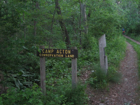
Off of Acton's Pope Rd across from a few farms is a dirt road that ascends to a trail leading to a dozen distantly separated campsite in a small forest of large pine trees. This is a secluded place to legally camp that few know about. It is a great destination for bike camping, it is only 20 miles from the city, much of which is on the Minuteman Bikeway and the Reformatory Branch Trail. The trail is also wide enough to easily bring your loaded bike into the campsite. It is also right on the Bay Circuit Trail and one could easily walk with a pack the four miles from the Concord train station

Harold Parker State Forest (DCR)

On the border of Andover and North Reading is this large state forest with a campground. It has mostly wooded with many lakes and walking trails. It is also 20 miles from the city, however the route is on busier streets. It is also on the Bay Circuit Trail and can be reached by foot from either the Ballardvale or Andover train stations with a 6 mile walk.

Winter Island (City of Salem)

A city beach and campground on the northeast tip of Salem. I know next to nothing about this destination, though Salem is a fun city to visit, with many museums, a nice downtown and a set of bike paths that go to the nearby quaint village and New Englang sailing mecca, Marblehead. Winter Island is also 20 miles from the city, though the roads in this direction are particularly unfriendly to cyclists (at least while the Northern Strand is not yet complete). Taking the Salem Ferry LINK or the train to the Salem station would be a good alternative with or without a bike.

Of course, there are plenty more campgrounds nearby, and further a field on the Cape, in Maine, and further, including Salisbury Beach, shown above. The following map collects many, and hopefully more as I learn them.


View Bike Camping Nearby in a larger map


Monday, November 21, 2011

200km to Portland & Return by Train

The plan: a beautiful fall ride along the New England coast from Boston to Portland, then catch the evening Amtrak Downeaster back to Boston.

The reality: we made it to Saco, fifteen miles short of Portland, where we encountered a huge Amtrak fail.

Jon and I wanted to get one last long ride under our belt before the winter restricted us to commuting and the short west Boston jaunt during the rare warm winter weekend. To further encourage us, the leaves were turning a little late this year, so there was still a little color left in early November, especially along the coast.

I knew that I would need all day to ride the 200km (120 miles) to Portland, so we met at my place before dawn for coffee and bagels. With lights running we headed north through Medford and Malden. By the time we hit Saugus the sun was up and time to switch our lights off.

Though rather direct, the route from Somerville to Peabody involves many turns making navigation a challenge. Once we arrived in Hamilton we rode on Route 1A much of the way to Saco. The ease of navigation here allowed us to spend more time enjoying the ride and the views. I believe our favorite section was the farming land and salt grass lands between Ipswich and Newburyport.

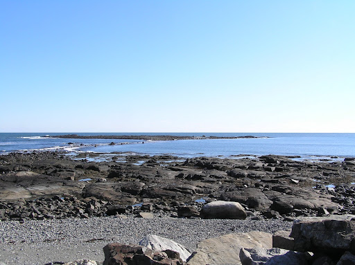
North of the Merrimac River our route was the coastal road all the way to Portsmouth. This stretch was largely uninterrupted coastal vistas. The southern portion is mostly large expanses of sandy beaches.

Further north the coast becomes rockier and thus hillier. But we were still fairly fresh, and the views were very worth it. If we lost any time on this section it was because the temptation to admire the views was too great.

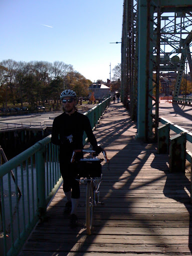
We pulled into Portsmouth about 1pm, just over six hours on the road. We found a good sandwich shop and ate them in the square. The day had become quite warm, and there were people everywhere outsode enjoying the day. Following lunch we headed north once again, this time to cross the Piscataqua River into Maine. The old downtown Rt 1 bridge is closed to automobiles, but you may still walk your bike across.

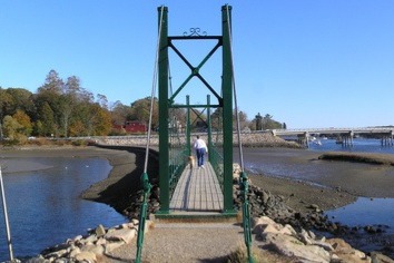
The portion in Maine was more wooded and the leaves had turned less. The roads were a little hillier, but still quite comfortable. While passing through York we found this great pedestrian bridge that we stopped to cross, and it provided a nice place for a snack.

Before we knew it we had arrived in Ogunquit. The traffic was heavier; more so as we reached Rt. 1. We decided turn inland towards back roads instead of riding on the busy road. The hills became more difficult, primarily because I was tiring. At least it afforded us the luxury of riding on a portion of the Eastern Trail, which was a true luxury. Aside from a few blow downs, the stone dust path was a pleasure to ride upon. The sun had just set, so we enjoyed the quite darkness without worrying about motorists.

This section of the Eastern Trail ends in Biddeford - there is another good section near Old Orchard Beach that I had ridden before. By the time we arrived in Biddeford it was getting too late to push on to Portland and still catch the 7:55pm train back to Boston. Knowing that there was a stop in Biddeford/Saco, we decided it was most prudent to have dinner and catch the train here.

This proved to be a great idea, until the train arrived and the conductor wouldn't allow us to bring our bikes on! I'd never caught the train in Saco, but I'd done so at Portland and Wells by bike without any trouble, indeed the past times worked very well. When we decided to cut the ride short at Saco I couldn't have imagined that Amtrak would not allow us on the train. Why would Saco be any different?

The only real difference is that Amtrak says so. Yet they don't say on their online schedule. Afterwards I found the fine print under the reservations & tickets page. They also display this bike caveat on their printed schedule, but they are only available at the stations, which wouldn't have helped us here.

So that every one knows, the Amtrak Downeaster only accepts bikes at Boston, Wells and Portland. I won't let this end my bike/train trips on the Downeaster, but it sure limits my ability to do so. it is a shame with the Eastern Trail passing through Saco/Biddeford and the Rockingham Trail near the Durham, NH station.

The route north was fairly straightforward, go north on the through road closest to the Ocean. To make it even easier I used Google Maps and selected the bike routing option, which provided a very good route. We also saw that this route is also arrowed from Ipswich, MA to Ogunquit, ME, and probably beyond. I can't recall the arrow, it was two letters. Does anyone know who arrowed the route and what the full route is?

View Larger Map

The only thing I would do differently next time would be to continue north along the coast through Kennbunk or Kennebunkport, instead of going inland. This may also save a little time and allow me to get to Portland without missing the train.

If you made it this far, I would like to share a short dream. This is a great route at a good length to ride north leaving just before sunset. The goal would be to reach Old Orchard Beach for the sunrise, have breakfast and continue on to Portland to catch the train home. A Boston version of the Dunwich Dynamo. We could call it the Dirigio Dynamo. Anyone in?

Saturday, October 22, 2011

Portland

Portland, ME has become on of my more favorite nearby cities to visit. It is near and similar to Boston, yet the differences are striking.

Like Boston it was settled on a peninsula, unlike Boston they did not fill the surrounding harbors and bays. The city still feels like a peninsula with water surrounding three sides. The architecture is similar, but without the multiple high-rises. The streets are still narrow, and the traffic isn't overwhelming.

A couple weeks ago, my wife and I took our son to Portland, and one of the nicest things for him was the abundance of parks. There were many playgrounds, but the open space, fields, trees, ponds and hills alone were entertainment enough. Deering Oaks Park is particularly nice.

Our friends, Dorea & Angela, over at Carfree with Kids recommended the Eastern Promenade, above. They also noted that at the top of the hill is a great cafe and next to it is a little market where we also got lunch. This area is probably one of my favorites, with nice restaurants, beautiful old homes, the signal tower and an expansive view of the boats sailing across Casco Bay.

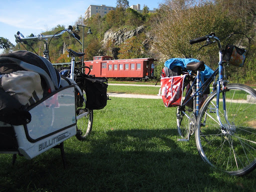
The promenade is near the top of a hill and it can be a long ride up to from the bike path, but well worth it. Speaking of bike paths, Portland has an ample supply. The back cove trail is nice with a crushed stone surface. Our favorite is the one along the bay just below the Eastern Promenade, it even has a narrow gauge tourist train, what more could one ask for?

The bike paths are primarily flat. The rest of the city is quite hilly. With modest traffic on a rather small peninsula with the abundant bike paths, cycling around the city remains a pleasure. Even the random cobble stone streets can be fun.

There is, of course, more to do than just bike around and go to parks. Here is a hand full of things we either did and would recommend, or would like to have time to have done ourselves:

  • The Standard Baking Company, down by the old port, by far the best bakery I've been to.
  • Portland Velocipede, a pleasant bike shop and they carry just about any urban utility bike that you may want, which includes a couple different bakfietsen!
  • Local 188, a fabulous dinner and even better drinks. I would recommend a reservation.
  • Children's Museum of Maine, we didn't get here but I've heard many good things.
  • Casco Bay Lines, which is the local ferry service. Of particular fun in Portland as there are so many islands that you could go visit.
  • Duck Fat Restaurant, after we returned I heard of this place and was sad that I missed it.

As for lodgings, we stayed at the Holiday Inn downtown. They had a small bike rack in the parking garage, which wasn't secure but was out of sight. It also had a door directly into the hotel and elevators making loading & unloading easy. The indoor pool was an added bonus.

The price was reasonable, and on the lower end for downtown lodgings. Some of the B&Bs are similar or less expensive. On past trips, we once stayed at the The Inn at St. John, which is inexpensive, quirky and a little far from the center of downtown. On another time we stayed at the The Percy Inn, which was a nice B&B on the border of the arts district and the west end neighborhoods, but a little far from the Old Port where most of the action is.

Portland is a fun place to be, and so is getting there from Boston. The Downeaster, an Amtrak train from Boston to Portland, is a great way to get there. The seats are comfortable, the conductors are helpful and the cafe car has decent food. For those, like us, wishing to take their bikes, well that is easy. The train has a large baggage car with bike racks, which we had used on a previous bike trip to Maine.

But this time we also had a cargo bike instead of two standard sized bikes. I knew it could fit in the baggage car, but I wasn't sure that would all work out. Luckily the train crew worked with us to get the baggage car open so we could get the two bikes in. Initially they wanted to put both bikes into the coach section; maybe they do not use the baggage car for bikes once summer has passed. Once in Portland the crew helped us get the bikes off the train, which would have been difficult to do it alone since the platform where the baggage car stops is 4' lower the car deck.

Worried that I would have to lift the bike back up the 4' when we left, asked the station agent for extra time to load. The agent requested that we load with business class. To our pleasure, they stopped the business class and baggage cars at the high section of the platform so we didn't have to lift the bikes.

I would definitely take large cargo bikes on the Downeaster again. Though I would definitely ask the Boston agent to let us board earlier.

Saturday, June 11, 2011

Camping in Acton

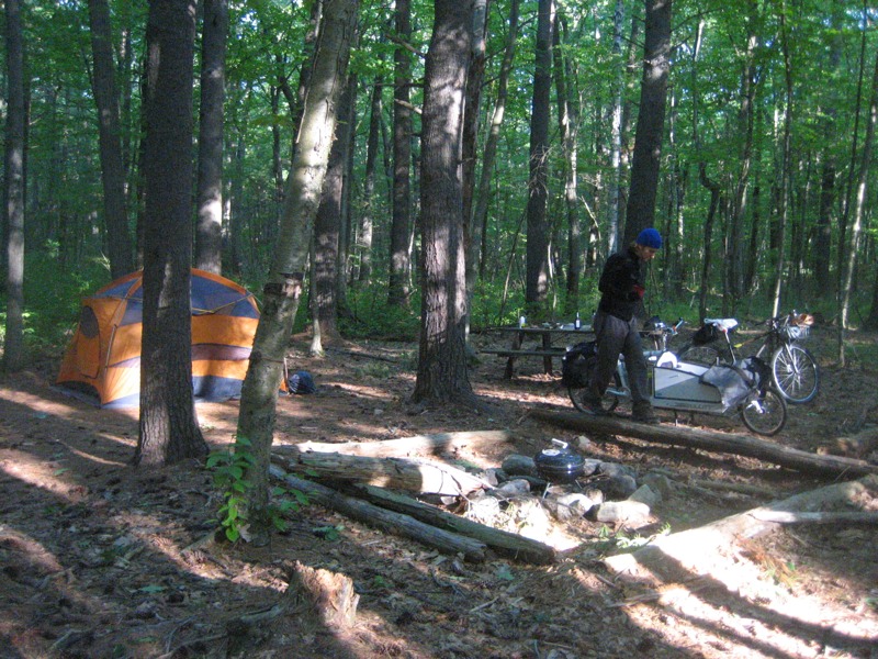
Urban bike paths, country lanes, revolutionary war sites, dirt paths can all lead to a majestic stand of tall old pine trees. Sheltered beneath the trees at an Acton conservation & recreation area we found a thick mat of pine needles to sleep upon for the night. An easy afternoon bike ride from Boston and we almost mistook our surroundings for western Massachusetts.


I've been looking for a few good camping trips within a short bike ride from Boston. One that I found is a small municipal camping area in the northeast corner of Acton.

My friend Jon, who is better known for his longer bike camping trips, joined me on this short trip. We set out on this trip as a S24O or Sub 24 hour Overnight, popularized by Rivendell Bicycles. We left around 6pm Friday, and we were home by noon Saturday.

Camp Acton isn't too far away, about 20 miles. There are many ways to get there. My favorite route, especially when loaded with camping gear, is the Minuteman since it is along an old rail bed, and is thus flatter than many of the onroad alternatives. We also used sections of the Reformatory Branch Trail and we rode the length of the Battle Road on our return.


No matter how you decide to get out of town, the route through Concord will take you along many pleasant country roads, with names such as Barrett's Mill, Strawberry Hill, Pope, Spencer Brook and Westford Roads.


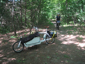
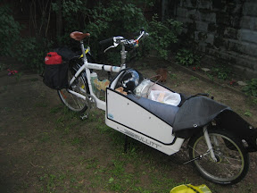
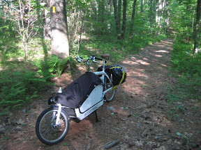
I would ordinarily take my road bike with panniers, or maybe just a saddle bag on a short overnight bike camping trip. However, I am recently a happy owner of a cargo bike, and I wanted to see how it would work as a touring & camping bike. This also gave us the opportunity to bring my luxurious four person tent and a charcoal grill!


Jon, instead, took the minimalist approach. Yet he was nice enough to ride a single speed so I could keep up.


No matter which extreme of bikes, or more likely somewhere in between, you'll be able to carry what you need for a short overnight. Remember, you will not be too far from civilization (or home) so you can skip the excessive gear. You could even skip the food altogether and eat at a nearby restaurant.


Getting permission to camp at Camp Acton was much easier than I anticipated. In fact it is very simple, fill out this PDF with your name, contact, fellow campers and date(s) you would like to camp. Then mail the completed PDF with a $15 per night night fee to:
Acton Recreation
Town of Acton
472 Main Street
Acton, MA 01720

I would recommend sending it a couple weeks before you plan to go. If you are feeling uncertain, as I did, you can call Acton Recreation at (978) 929-6640. A very friendly lady named Cheryl helped me through the process and emailed me my permit once it was a approved.

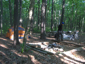
Of course you also need to select one of the seven campsites, and they are all good. The camp is in a large pine forest, so the ground is comfortable to sleep on covered in a thick mat of pine needles. Plenty of space between trees to set up even the largest of tents, and good tree placement if you prefer sleeping in a hammock. And each site has a picnic table and a large fire ring.

The mosquitoes were quite difficult at dusk and dawn; we ended up breaking camp quickly in the morning and eating breakfast at the North Bridge. Another friend lives nearby and notes that the mosquitoes are more tolerable later in July and August when it is drier. We went in early June and it was still quite damp.

The camp used to be an old Boy Scout campground, and is still used by scouts from time to time. The two sites closest to the road and small parking lot are very large intended for groups. We stayed at the seventh site, thinking it would be the most secluded, which it was. Seven was also very open, high and dry. All seven sites are on the same trail. The trail was sufficiently wide, not too steep with few rocks and roots, so it was easily passable by bike.


Before we left we checked out the remaining campsites. Here are a few summaries.
Sites 1&2, next to each other, large group sites.
Site 3 was small on the top of a small hill.
Site 4 had room for two or three tents on the side of a hill that the fire ring was built against.
Site 5 was far from the trail and a little difficult to get to by bike.
Site 6 was nice but surrounded by undergrowth so only a couple tents would fit.
Site 7 had plenty of room to spread out with three or more tents and bikes, yet didn't feel like a group site.

Friday, June 3, 2011

Guest Post: Family Biking - Cape Cod

Brian was kind enough to invite my wife and I to write up our Memorial Day bike trip through Cape Cod on his fine, fine blog, so I (Kyle) will give it my best shot and try not to break anything in here.


First, a tiny bit of background.  We are a couple in our mid-30's with a 21 month old girl, we own no cars and 6 bikes, and we're chiefly practical city bikers.  The young'un has been in a bike trailer from 5 months old, and now in a Bobike seat for the last 2 months.  Thus, in contemplating a multi-day bike trip with our daughter along, we had a fairly good idea what to expect from her.  The longest trip with her in the Bobike prior to this was probably 3 hours of seat time in one day, possibly 4.  For this Cape trip, we were estimating more like 6 a day, with breaks of course.

 Next, a quick blurb about gear and setups.  My wife rode a 70's Phillips 3 speed with a new Sturmey-Archer 3 speed rear hub and an added front caliper brake.  Her bike has a big steel + cedar japanese front rack, and a cheap aluminum rear rack.  I rode a new Trek Belleville which comes with a Shimano Nexus 3 speed rear hub and a generator front hub to run lights.  The Trek comes with stout front and rear racks, and the whole thing is powder coated.  Each bike cost us about $700 with everything on it, in its current state of tune, I would guess.  Each weighs around 40 lb's, I am guessing, and mine is heavier than hers... I know I don't want to actually weigh mine, for fear of being cripplingly depressed.  I'm happier not knowing.  On each of our front racks, we tossed on a big open Coleman aluminum-framed basket, held on with one bungee cord (visible below). On the rear racks we brought 3 panniers, and a bungee net containing a huge beach blanket.  So, the trip...

We took the Provincetown ferry out from Boston friday afternoon at 5:30, which put us in P-Town by 6:30.
The ferry was a pleasant experience, and we'd both strongly recommend it.  The bikes are secured by staffers using stout rope, and I didn't see anyone's bike so much as twitch during the ride, though we did have calm seas. There is basic food in the galley, a full bar, enough seating for everyone, and the views are spectacular.  We even saw a whale!  I got no picture of it, sadly, but I saw the back and the fluke, and it was my first real whale sighting.


Once on shore, we biked to the motel we'd found.  If you're going to do this, finding places who will rent to you for just one night can be tricky.  The hotels, motels, and b&b's of the cape would really, really like you to stay for 3 nights at least on Memorial Day weekend. You, on the other hand, would not like to stay for 3 nights... you have places to bike.  What we did was book it all last minute, literally the day before, and Google/Yelp/call like hell until you track someone down who has vacancy.  At this late point they're pretty happy to get one night's worth of dough from someone instead of nothing for any rooms available. We had to find places with a crib, too, so if you don't have that hangup you'll have even better luck.  A basic understanding of Guest Industry economics and some blind faith will serve you well here.

Depending on how many days you have to do this and where you will end the biking portion of your journey, you could be doing anything from 20 to 60 miles a day.  In our case, we did 30-something a day, roughly, plus excursions, and it was very manageable even with the kiddo and the slow bikes.  Also, we lucked out on heat - it was cloudy but dry, with temps in the 60's and 70's for the most part.

Loaded up and ready, Saturday morning in the fog:


6A leaving Provincetown:

The northern section of 6A from PTown to North Truro is pretty pleasant to bike.  The traffic was minimal for us, drivers were slow and considerate, and people are generally not in a giant rush. There's really nothing else to choose from, so you'll wind up on it. The cape feels skinny here - you can see the water on one side and sense that it isn't far off on the other side. Up here it's still really VacationLand.  Soon it will be less so.

At North Truro, laid-back slacker Route 6A joins up with its faster, loudmouth big city cousin Route 6 Proper, and the ride becomes less pleasant. There are 2 lanes each way, cars go as fast as they can manage (70+), but there is a decent 4-foot shoulder, so the more hardened riders (and especially those without a toddler between their elbows) can probably stay on 6 and make bullet-like progress south, if that's desired. We opted out.

The only problem with opting out is that every road except 6 between North Truro and Truro looks like you tossed a handfull of cooked spaghetti at the map.  Also there are hills. If you're on a carbon-framed jobby with 4 lb's of gear total on it, have no fear.  If, however, you're on a powder coated steel battleship with 75 cubic liters of stuff and two breathing life forms on it, the hills will be a bit of a challenge. It's manageable, there are almost no cars - we rode side by side - and the scenery is woodsey and wonderful.  But this is the one section of the whole trip that felt like work. Pull over and have a beer to shore up your fortitude, but watch for ticks...  there are tons of them, and you are delicious.


Wellfleet is where we had lunch. The oysters are indeed worthy of the hype, my wife assures me.  (I only eat them cooked, and [20 miles into an 80 mile trip + bike shorts time to try out new raw seafoods]). At Wellfleet we joined back up with interstate-wannabe Route 6 for a few miles, until the rails-to-trails bike trail started just after South Wellfleet. There was a sign pointing it out to the left, so we carefully merged over and rode down through a parking lot, up a path, and there it was...

Once the bike path starts, the miles begin to fly past. My wife commented that she felt no sense of progress on the path, because there were so few things pasing by with which to mark the distance.  I, on the other hand, had a gps unit on my handlebars quietly doing a bunch of math and whispering encouraging things to me. I suddenly saw a huge difference in both our whole-trip total moving average speed (from 9.8 to 10.4mph in about 1 hour), and the distance left to our destination as measured in a straight line. There is a tool for every job, and if your job is mile munching by bike, then the Cape Cod Rail Trail is the right tool.  Some history on it:

"Somewhere around the elbow" was our target range when we were trying to find a place to stay for Night 2, and we found an incredible place in Chatham that I will gladly name-plug here: Pleasant Bay Villiage.  They have what I would lovingly call a "compound," consisting of a motel-row front, behind which are paths and ponds and trees and fountains, populated with small houses and other nicer rooms for rent as well.  Everything is landscaped in a very japanese style, it's family friendly without being noisey, and the staff was VERY friendly and helpful to the last man.  The dog that hangs around the front office is still the largest I have ever seen, even after having slimmed down from 200lb's to 135 on a diet of frozen carrots.  They also have a nice pool and a hot tub, though I cannot guarantee that the latter will not be clogged with 14 men in t-shirts and sunglasses discussing golf.
We settled in, got the baby fed, and put the integrated bottle opener to good use.

Sunday morning we had to use more 2-lane busy roads to get back to the rail trail, which was less than ideal.  Cars south of Chatham (Training Field Rd, George Rider Rd) were uniformly doing 15-25 over the speed limit and not pleased to see us laboring along on the right shoulder. The worst offenders were work pickups, a dump truck, and a guy in an unidentifiable bondo-grey mid-60's Dodge with open pipes who thought it would be great fun to dump the throttle once he got right alongside us. Less than an hour after we started, we got back onto the path next to Chatham Municipal Airport.

From here it's smooth sailing west all the way until you hit 134, at which point the bike path ends. This is the end of it... some bricks, a map, and a parking lot.
After this you're back on surface roads as you head west.  We incorrectly headed north for a block or two, as seen below from the GPS track data, then realized it and went south.
Then you pick up Highbank Rd going west northwest, which leads you pleasantly enough up to 6A near Yarmouth.  6A is pretty decent for bikes.  It winds and twists gently, the hills aren't imposing or frequent, and the towns you're going through are incredibly quaint.  We had a great meal for lunch in Barnstable at the Barnstable Restaurant & Tavern.  The outdoor patio is wonderful, the Cape Cod IPA (brewed right down the street) punches above its weight class, and the mediterranean stew hit the spot.

 Back to the business of going west.  6A looks like this...
...and then this...
...and then you're in Sandwich, more or less.

Sandwich is a cute / serviceable little town with some basic amenities but not a ton to choose from.  We stayed at the Belfry Inne / Painted Lady Inn, which are side by side and share ownership and operations.  That night there was a wedding, so we couldn't eat in the Belfry, and were left with slim pickin's.  We ended up calling in an order to a pizza/burrito joint, and the $24 meal wasn't amazing. The Painted Lady is an old mansion-turned-hotel that has excellent bone structure but whose interior has been regretably slathered in whore's makeup. The decor consists of high-density kitsch and a collection of awful folksy "humor" paintings, far too many of which feature half naked mermaids. Noise travels through the floors like water through a screen, so if you stay here, aim for the highest floor you can get. We stayed at ground level and heard every footstep and dropped TV remote above us with unwanted clarity, in addition to chatter from people in the small "bar" room across the hall from us. Drink some beer and bring earplugs.

Sure is pretty, though!

Getting home... We had planned to ride up to Plymouth to take the commuter rail back to Boston, but it's been closed every weekend for awhile now for repairs.  That left us with an easier-yet-pricier option, the P&B Bus Line which picks up right over the Sagamore bridge.  It took maybe 30 minutes from Sandwich to the bus pickup spot, which is in the parking lot next to the Shell gas station.  Tickets are sold inside the Shell, and 2 adults + 2 bikes cost us $44.  The bus was clean, had good a/c, was at less than 1/2 capacity, and had us home in an hour flat. It picked up once an hour, so if you're close by at the end of your trip and don't feel like slagging it out all the way to Plymouth, this was a good option.

Specifics like trail on/off points, gps coordinates, etc, available upon request.  Cheers and thanks again Brian!

-Kyle, Megan & Annika
Tuesday, November 2, 2010

A Mystic River Ramble

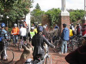
Every year the Somerville Bicycle Committee hosts the Tour de Somerville. This year's ride was so enjoyable that I figured it would make a fine urban jaunt in it's own right.

The route is almost entirely on separated bike paths from Davis Square to Alewife Brook, and following the Mystic River downstream to the Blessing of the Bay Boathouse in Ten Hills Village.


We began near the Davis Sq T Stn, you of course could start anywhere on the Somerville Community Path.

As you may notice, I'm in the photo with the microphone. Since I was helping lead the Tour, I must thank Doug Mink at masspaths.net for taking these photos and sharing them.

The beginning of the tour is fairly straightforward, going out the Linear and Minuteman Paths towards the Alewife T Stn. But once we pass into Arlington and under the Rte. 2 bridge it starts to get interesting. Just before the path veers left around the fenced in area, take a right turn into the neighborhood. You pass between some stone blocks onto Thorndike, which is a dirt road here. Immediately take another right onto a narrow, dirt trail.

In short order this trail will take you over to the new Alewife Brook Path. Heading left, downstream, on this path is pleasant. There are a few openings out to the brook. It isn't long before you reach Mass Ave. It is best here to take the right onto the sidewalk and cross Mass Ave at the intersection.

The path on the Cambridge/Somerville side of the Brook is next to Rte. 16, but the benefit is that it is paved. The Brook will have trails on both sides, the Arlington side being unpaved.

Since the paths are still under construction, the section between Woodstock Street and Broadway is not passable. It is best to ride through St. Paulson cemetery, easily accessed by crossing the little Woodstock St Bridge, and taking the next two right turns.

After crossing Broadway the route passes by a number of ball fields, a public DCR pool and Dilboy Field. The path here is already very well paved.


Next you cross the Mystic River Parkway. After crossing, going left will take you upstream along some existing paths to the Mystic Lakes. But we went right to continue downstream towards Medford. This section has very nice, large grass fields, but the could use some repaving. Luckily e DCR has a plan for improving this section.


Just after you cross under the railroad bridge, which will hopefully be the terminus of the proposed Green Line extension, you'll reach a bridge across the Mystic River. Here you want to cross Rte. 16 and the bridge. The path near the river is only a walking path in a grass field. A pleasant ride if you have wider tires.

The path soon is paved again and you pass the recently refurbished Medford band shell.


Continuing along the path you eventually have to cross Rte. 16 at a signaled cross walk. The path will take you to a crossing at Main Street, cross the bridge over the river and take an immediate right onto Clipership Drive. You are right next to Medford Center, so if you need to stop for a snack, now is the time.

Take the next right onto Riverside, at the light. Continue underneath I-93. Take your first right again into Park. A very short road, and across the road is a yacht club parking lot. Cross to the far end of the parking lot and ride along the grasses walkway to end up on another set of Mystic River paved paths.

Along this section you'll see Medford new wind turbine. Proceed along the path and cross over the river and under Rte.16.


And continue on the path that continues along the Somerville side of the Mystic.


This path has some unique views with a mixture of wilderness and the city.


From Riverside this is one of the longest sections of path without any street crossings that I know. That path ends at the Blessing of the Bay Boathouse, where we had refreshments provided by RedBones.


Unfortunately, Red Bones won't be there when you ride by. So you should just join us on next years Tour de Somerville.

Now I know that this route can be difficult to follow. It could really use some signage. But in the meantime here is a map that should help!


View B&J Mystic River Ramble in a larger map