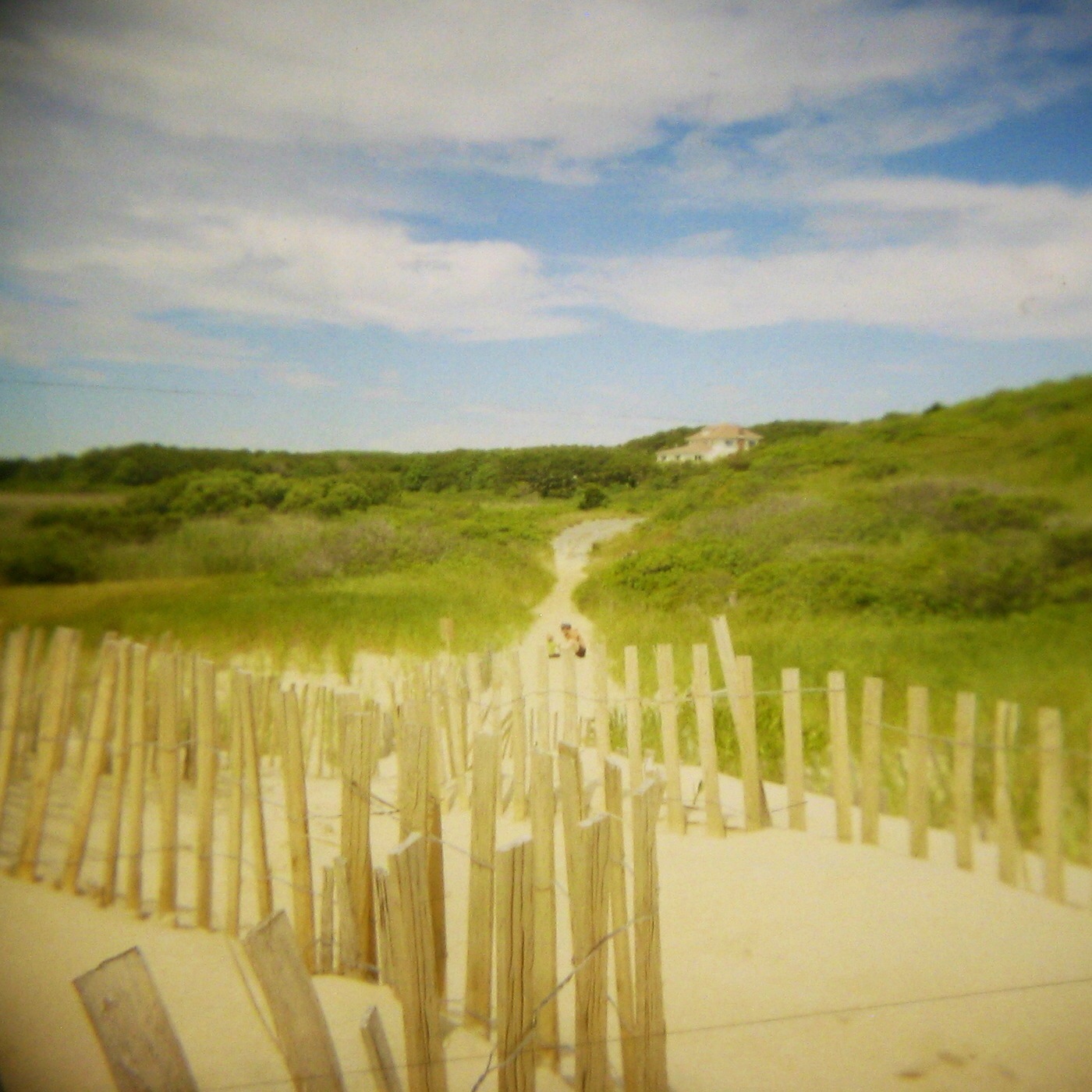
I grew up on the coast, and I'm accustomed to many US beaches, particularly in the south. Recently I found the most dramatic beaches may be those of the outer cape along Wellfleet and Truro.
The outer cape is an easy place to get to from Boston with the ferry (Boston Harbor Cruises & Baystate Cruise Company), especially since it is easy to carry bikes on board, even cargo bikes fit easily. The corners getting on the ferry and through the ferry cabin are tight and require some rear wheel lifting, and the gangway in P'Town is on the narrow side. I've heard that a loaded Longtail will fit, but I'm not sure about a Workcycles Bakfiets. All in all very doable and easier than getting a cargo bike on & off the Downeaster.
Of course once in P'Town there are many activities and places to stay. We visited many times before but can be a bit crazy, and we were looking for something more relaxing. So, we headed south to the sleepy town of Truro. The ride along Shore Road is nice with views of Massachusetts Bay with numerous vacation cottages along beach line. It is flat and a little windy.
But once Shore Road leaves the shore it becomes very hilly and remains so through Truro and into Wellfleet. When riding an overloaded cargo bike (or with a kid and a full basket) the ride becomes more work and less fun. There are no mountains on the Cape, but don't let the hills on the outer Cape fool you, they are steep and relentless when it comes to casual touring. I haven't found a flatter route, which is frustrating since there once was a railroad to P'Town, much of which is now a rail trail. But that flat route across Truro was dissected by homes.
Worse than the hills was US 6, a four-lane highway that provides the only link through Truro. This is a one mile section along US 6 from Shore Road to Castle Road, with no parallel route. Despite the generous shoulder, this one mile of cycling with uncomfortably fast traffic sucks all of the enjoyment out of the bicycle ride. We won't cycle to Truro again until we find an alternate route, but many families are less daunted by fast traffic.
An ocean side alternate might exist using the Old Kings Highway, which may be less hilly but mostly unpaved. An exploratory trip is in order. Some good friends tried a similar route with mixed results.
And then we arrived at the Truro hostel and all was good in the world again. The hostel is an old life saving station, precursor to the Coast Guard where men were stationed to rescue shipwrecked crew and passengers. It is at the end of North Pamet Road, within sight of the beach. And a nice beach it is.
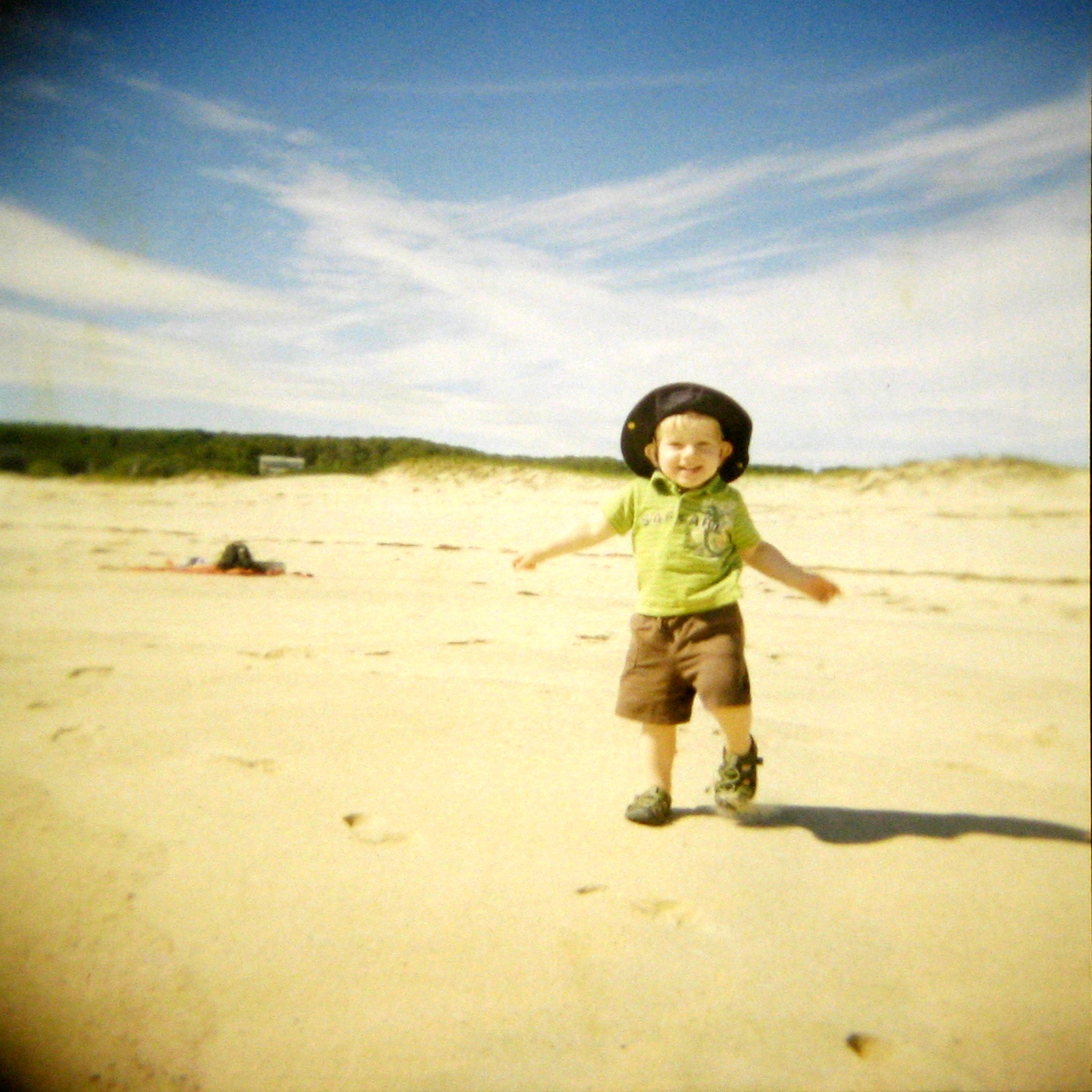
It was June and the water was very cold, but we enjoyed building sand castles, flying kites, watching the seals swim in the surf, walking along the beach and the nearby trails. Not to mention the book reading, and relaxing. Well, as much relaxation as can be had with a toddler running about.
The hostel, like most, is no frills and comfortable with a large sitting room and spacious dinning room/kitchen, with plenty of fridge space and cooking implements. We brought all of our food, but next time we would buy all of the heavy stuff, if not everything, at the upscale market at the corner of South Pamet and Truro Center Road (the premium is more than offset by not carrying as much).
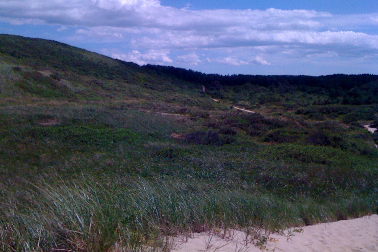
The hostel is maybe 100 yards from the beach, and they have all of the beach stuff you could want, chairs, towels, blankets, umbrellas, buckets, shovels, etc. We would leave all that home next time too. The beach is a wonderful place to walk (in fact I walked my son out their both nights to lull him to sleep in the unfamiliar place). Along the beach I could easily imagine walking all the way back to P'Town. In addition to the beach, there are numerous inland trails, just on the other side of the dunes. These are mostly woodland, but often wind up to the top of grassy dunes (read small hills) with great views of the ocean, and sometimes back to the bay. I hear these trails parallel the beach much of the length of the cape.
All in all this was a great destination and trip. It will be perfect when I find an alternate to US6, so next time we'll stay in P'Town. It may not be soon, but we will go to Truro again. If you would like to hear a different perspective of a Cape Cod bike trip check out our friend's trip a couple years ago.
Showing posts with label trails. Show all posts
Monday, August 18, 2014
Saturday, May 12, 2012
Camp Boston
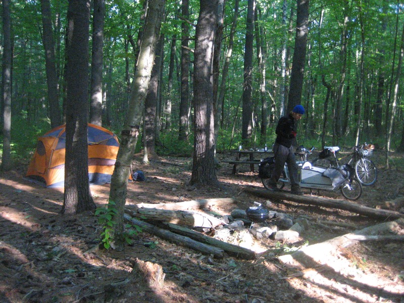
Summer is almost here and thus camping season has begun. I grew up thinking of camping as either hiking on trails or car camping. But since moving to Boston I've learned that there is also bike camping, ferry camping and train camping. Though I haven't made the time to go on all of the camping trips I've wanted, I have found the time to compile a list of camping destinations near Boston.
Boston Harbor Islands (DCR & NPS)
The closest and most iconic Boston camping destination, and possibly even the easiest. There are three different islands you could camp on, ranging from old forts to secluded wilderness. Peddocks Island will soon be offering tent and yurt camping too. The islands are beautiful, with unique views of Boston, and often a lot of rabbits. For being so close to the city, they are also very remote, no water or electricity, and you can only get there by ferry, water taxi or private boat.
To go, pack light or pack in a rolling device and take the T to the Aquarium stop. The ferry dock is adjacent to the Christopher Columbus Park (not next to the aquarium). The ferry goes to George's Island (no camping) where you catch a second ferry to your particular island. You will need to be able to carry all your stuff in one trip to get on and off the ferries. Of particular note due to its remote nature, campers have to bring your own water, and carry of all of their trash.
Wompatuck (DCR)
Wompatuck State Park is on the South Shore and I don't know much about it, however it is large and I understand it has many good bike trails & roads. There is also the adjacent Weir River Farm and Whitney Thayer Woods, not to mention the nearby Worlds End Reservation; all are places I've been wanting to visit and haven't. It might be a great bike camp destination by taking the ferry from the Acquarium dock to Hingham and cycling the six miles to the campground, or take the train from South Station to Nantasket Junction for a four mile ride.
Ponkapoag Camp (AMC)
The AMC is well known for their White Mountain lodges and camps, but they are based in Boston and have a camp in our own backyard Blue Hills. It is very much geared to families. Reservations are focused towards week long stays, though I believe you can reserve a weekend. They have both tent areas and cabins. And for the parent that can't take the full week off, it is close enough to the city where you could still commute. It probably isn't best to cycle there, but a combination of the red line and Bus #240, and three mile walk on trails through the Blue Hills.
Camp Acton (Town of Acton)
Off of Acton's Pope Rd across from a few farms is a dirt road that ascends to a trail leading to a dozen distantly separated campsite in a small forest of large pine trees. This is a secluded place to legally camp that few know about. It is a great destination for bike camping, it is only 20 miles from the city, much of which is on the Minuteman Bikeway and the Reformatory Branch Trail. The trail is also wide enough to easily bring your loaded bike into the campsite. It is also right on the Bay Circuit Trail and one could easily walk with a pack the four miles from the Concord train station
Harold Parker State Forest (DCR)
On the border of Andover and North Reading is this large state forest with a campground. It has mostly wooded with many lakes and walking trails. It is also 20 miles from the city, however the route is on busier streets. It is also on the Bay Circuit Trail and can be reached by foot from either the Ballardvale or Andover train stations with a 6 mile walk.
Winter Island (City of Salem)
A city beach and campground on the northeast tip of Salem. I know next to nothing about this destination, though Salem is a fun city to visit, with many museums, a nice downtown and a set of bike paths that go to the nearby quaint village and New Englang sailing mecca, Marblehead. Winter Island is also 20 miles from the city, though the roads in this direction are particularly unfriendly to cyclists (at least while the Northern Strand is not yet complete). Taking the Salem Ferry LINK or the train to the Salem station would be a good alternative with or without a bike.
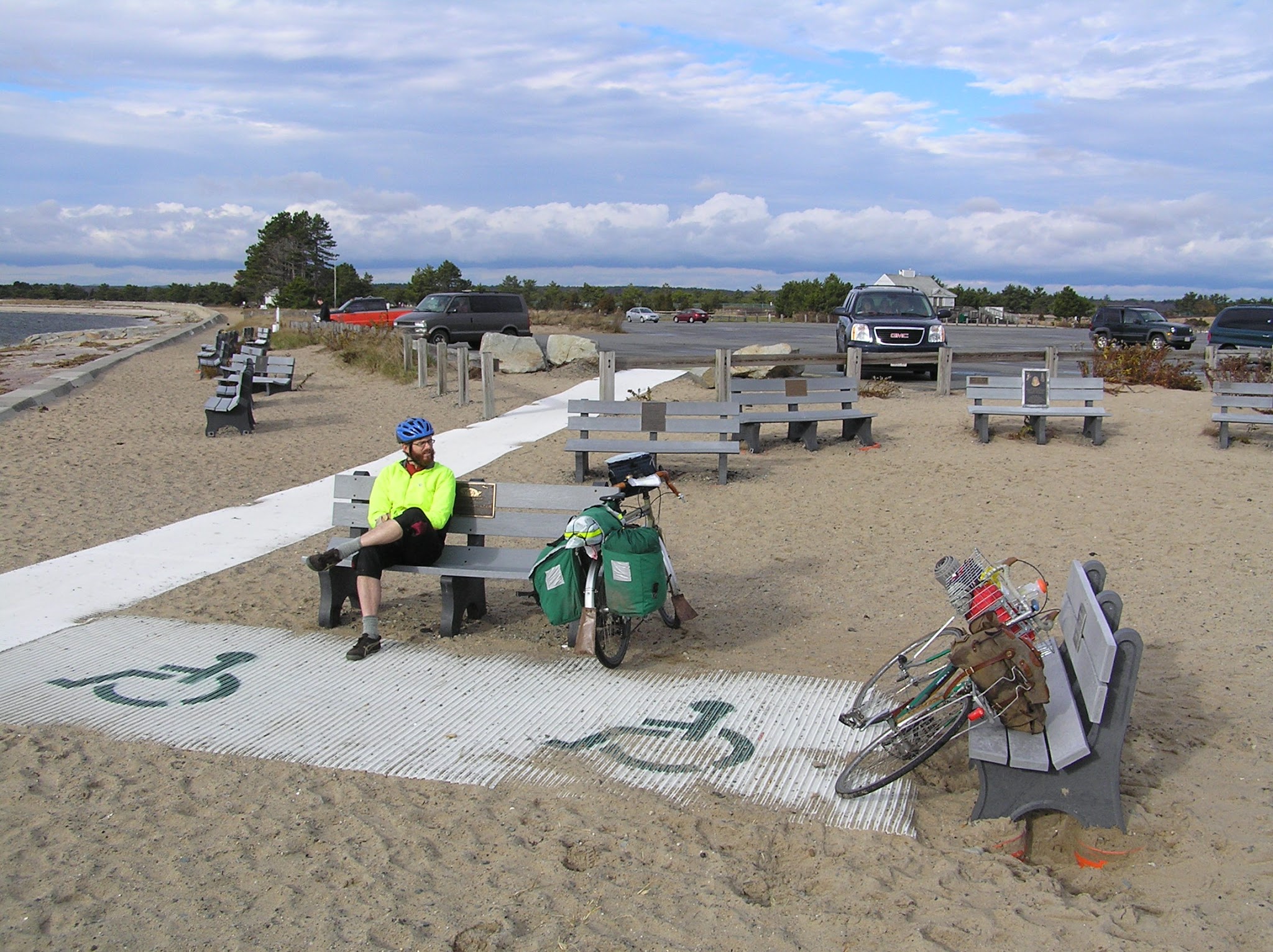
Of course, there are plenty more campgrounds nearby, and further a field on the Cape, in Maine, and further, including Salisbury Beach, shown above. The following map collects many, and hopefully more as I learn them.
View Bike Camping Nearby in a larger map
Boston Harbor Islands (DCR & NPS)
The closest and most iconic Boston camping destination, and possibly even the easiest. There are three different islands you could camp on, ranging from old forts to secluded wilderness. Peddocks Island will soon be offering tent and yurt camping too. The islands are beautiful, with unique views of Boston, and often a lot of rabbits. For being so close to the city, they are also very remote, no water or electricity, and you can only get there by ferry, water taxi or private boat.
To go, pack light or pack in a rolling device and take the T to the Aquarium stop. The ferry dock is adjacent to the Christopher Columbus Park (not next to the aquarium). The ferry goes to George's Island (no camping) where you catch a second ferry to your particular island. You will need to be able to carry all your stuff in one trip to get on and off the ferries. Of particular note due to its remote nature, campers have to bring your own water, and carry of all of their trash.
Wompatuck (DCR)
Wompatuck State Park is on the South Shore and I don't know much about it, however it is large and I understand it has many good bike trails & roads. There is also the adjacent Weir River Farm and Whitney Thayer Woods, not to mention the nearby Worlds End Reservation; all are places I've been wanting to visit and haven't. It might be a great bike camp destination by taking the ferry from the Acquarium dock to Hingham and cycling the six miles to the campground, or take the train from South Station to Nantasket Junction for a four mile ride.
Ponkapoag Camp (AMC)
The AMC is well known for their White Mountain lodges and camps, but they are based in Boston and have a camp in our own backyard Blue Hills. It is very much geared to families. Reservations are focused towards week long stays, though I believe you can reserve a weekend. They have both tent areas and cabins. And for the parent that can't take the full week off, it is close enough to the city where you could still commute. It probably isn't best to cycle there, but a combination of the red line and Bus #240, and three mile walk on trails through the Blue Hills.
Camp Acton (Town of Acton)
Off of Acton's Pope Rd across from a few farms is a dirt road that ascends to a trail leading to a dozen distantly separated campsite in a small forest of large pine trees. This is a secluded place to legally camp that few know about. It is a great destination for bike camping, it is only 20 miles from the city, much of which is on the Minuteman Bikeway and the Reformatory Branch Trail. The trail is also wide enough to easily bring your loaded bike into the campsite. It is also right on the Bay Circuit Trail and one could easily walk with a pack the four miles from the Concord train station
Harold Parker State Forest (DCR)
On the border of Andover and North Reading is this large state forest with a campground. It has mostly wooded with many lakes and walking trails. It is also 20 miles from the city, however the route is on busier streets. It is also on the Bay Circuit Trail and can be reached by foot from either the Ballardvale or Andover train stations with a 6 mile walk.
Winter Island (City of Salem)
A city beach and campground on the northeast tip of Salem. I know next to nothing about this destination, though Salem is a fun city to visit, with many museums, a nice downtown and a set of bike paths that go to the nearby quaint village and New Englang sailing mecca, Marblehead. Winter Island is also 20 miles from the city, though the roads in this direction are particularly unfriendly to cyclists (at least while the Northern Strand is not yet complete). Taking the Salem Ferry LINK or the train to the Salem station would be a good alternative with or without a bike.
Of course, there are plenty more campgrounds nearby, and further a field on the Cape, in Maine, and further, including Salisbury Beach, shown above. The following map collects many, and hopefully more as I learn them.
View Bike Camping Nearby in a larger map
Saturday, January 28, 2012
Towers Atop Boston
I figure most of us enjoy a good vantage point to observe the world, or at least over Boston.
To see a region altogether, a view up high is particularly helpful. I've found there are a number of such opportunities in the Boston area. What's more, they are fun to get to. Take Wright's Tower, as an example.
Starting in Medford Square (bus 94 or 96 from Davis), the walk into the Middlesex Fells is quite pleasant. Through the nearby neighborhood, walk north to the Fells through; I recommend Ashcroft Road.
As you get closer to the Fells you will notice a rockier topography. At the end of the neighborhood you reach the Fells near Bellevue Pond. Follow the old Quarry Road to the too of Pine Hill and you will find Wright's Tower.
The tower is open year round during the day with a short climb to the top, which affords a distant view of the Boston skyline (opening image, above). In the other direction is a sweeping view of the Fells, appearing as if there were no further development from here to Mt. Wachusett on a clear day.
Closer to Boston we find Prospect Tower in Union Square, Somerville (87 from Lechmere & Davis). It is on the top of a rather steep hill to the north of the square. The view of Boston and Cambridge from the top is fabulous, but always wintry.
Unfortunately, the City only opens the tower to the public on January 1st, during their celebration of the first American flag raising at this location. The celebration and the view are worth the mid winter trek.
Another great view of the city, which is open year round is everyone's favorite in Charlestown, the Bunker Hill Monument. Best arrived at by walking through the old Charlestown neighborhoods from the Community College Station. The 221-foot tall tower commemorates the Battle of Bunker Hill, and affords a good 294 step workout to get to the top. This effort is not wasted since it is the closest tower to the center of the City, which provides striking views of the City that you can't get further away.
Sadly, the viewing area is cramped with four very small windows with grates, which diminishes an otherwise spectacular view of the City.
Of course, I saved my favorite tower for last.
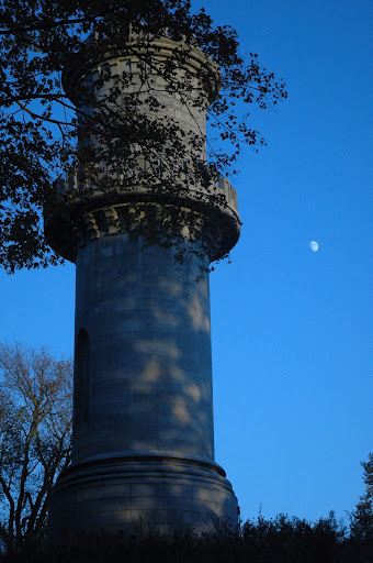
May I introduce the The Washington Tower in the Mount Auburn Cemetery (71 or 73 from Harvard). The experience is nothing short of majestic. I find it best to walk aimlessly through the Cemetary. Walk somewhere you haven't walked before. Work your way to higher points, eventually you may find yourself at the foot of the tower. Proceed to the top, it is a good climb but not tiring.
Observe the world.
To see a region altogether, a view up high is particularly helpful. I've found there are a number of such opportunities in the Boston area. What's more, they are fun to get to. Take Wright's Tower, as an example.
Starting in Medford Square (bus 94 or 96 from Davis), the walk into the Middlesex Fells is quite pleasant. Through the nearby neighborhood, walk north to the Fells through; I recommend Ashcroft Road.
As you get closer to the Fells you will notice a rockier topography. At the end of the neighborhood you reach the Fells near Bellevue Pond. Follow the old Quarry Road to the too of Pine Hill and you will find Wright's Tower.
The tower is open year round during the day with a short climb to the top, which affords a distant view of the Boston skyline (opening image, above). In the other direction is a sweeping view of the Fells, appearing as if there were no further development from here to Mt. Wachusett on a clear day.
Closer to Boston we find Prospect Tower in Union Square, Somerville (87 from Lechmere & Davis). It is on the top of a rather steep hill to the north of the square. The view of Boston and Cambridge from the top is fabulous, but always wintry.
Unfortunately, the City only opens the tower to the public on January 1st, during their celebration of the first American flag raising at this location. The celebration and the view are worth the mid winter trek.
Another great view of the city, which is open year round is everyone's favorite in Charlestown, the Bunker Hill Monument. Best arrived at by walking through the old Charlestown neighborhoods from the Community College Station. The 221-foot tall tower commemorates the Battle of Bunker Hill, and affords a good 294 step workout to get to the top. This effort is not wasted since it is the closest tower to the center of the City, which provides striking views of the City that you can't get further away.
Sadly, the viewing area is cramped with four very small windows with grates, which diminishes an otherwise spectacular view of the City.
Of course, I saved my favorite tower for last.
May I introduce the The Washington Tower in the Mount Auburn Cemetery (71 or 73 from Harvard). The experience is nothing short of majestic. I find it best to walk aimlessly through the Cemetary. Walk somewhere you haven't walked before. Work your way to higher points, eventually you may find yourself at the foot of the tower. Proceed to the top, it is a good climb but not tiring.
Observe the world.
Friday, September 17, 2010
A Short Hike with a Distance Wanderer
I needed to put on my hiking boots and grab my pack for a good weekend hike. Conveniently, a high school bud is hiking the AT and crossed New England last month. I kept tabs on Apple Juice as he headed north. As we approached a weekend, I left work early on Friday to join him for the weekend.

I enjoyed hiking with a thru-hiker. Having only hiked on long weekend trips, it was fun to see, first hand, the community that develops amongst those on the trail for so long. In particular, I've always enjoyed the trail names that the thru-hikers give each other.
I've yet to even consider thru-hiking any long distance trail, let alone the AT. I'm not sure how many of these mornings I could handle in a row.

But the hiking was beautiful. And food after a long days hike always tastes better than it should.
I'm sure I slowed Apple Juice down a little bit, but I felt great by Sunday noon when my weekend hike was almost through. At the Bennington overlook I was even given a trail name.
A couple of the other thru-hikers asked what was that thing down in the valley. It kind of looked like the Washington Monument, but smaller. I was able to dig deep in my past to remember it was the Bennington Battle Monument. It was built over 100 years ago to commemorate the successful revolutionary battle fought here. And now I'm known as Tour Guide, or Tour for short.
With a weekend of hiking done, how do I get back to my truck nearly 20 miles away in North Adams. Luckily, I thought ahead on Friday, and stashed my basket bike at the trailhead that I planned to end at.

After checking the map, and squeezing my backpack into the basket, I rode off. The twenty-five miles through Bennington, and the surrounding farmland back to my truck in North Adams was a great end to the trip. Going out of Bennington was a steep climb for an overloaded three speed, but the rest of the ride was mostly downhill or along the river.
View B&J N Adams - Bennington in a larger map
Short of going to the White Mountains or the Adirondacks, most overnight hiking around here is on long distance trails with few parallel trails. Long loop hikes can be difficult to find. But if you spot your bike at the end of the trail you can easily ride back to your car.
A few lessons that I learned. One, make sure your trail ends higher than where you start, it is much easier to hike uphill than it is to bike the same climb. Two, take your time cycling back to your car, you're probably already tired. Three, there is less shade while cycling than while hiking, dress and water accordingly. Four, a large basket up front seems a lot easier than trying to figure how to fit a backpack on a rear rack.
There are number of longer trails in the area. Most would be good for an over night or two with a return by bike.
Mattabesett Trail, CT
Metacomet and Monadnock Trails, Ma & NH
Monadnock-Sunapee Greenway, NH
Midstate Trail, MA
Wapack Trail, NH
North-South Trail, RI
One could also bike & hike the Bay Circuit Trail, though it is also convenient to get to by MBTA without needing a shuttle at all.
Happy trails, and let me know if you've done a good couple day hike nearby.

I enjoyed hiking with a thru-hiker. Having only hiked on long weekend trips, it was fun to see, first hand, the community that develops amongst those on the trail for so long. In particular, I've always enjoyed the trail names that the thru-hikers give each other.
I've yet to even consider thru-hiking any long distance trail, let alone the AT. I'm not sure how many of these mornings I could handle in a row.

But the hiking was beautiful. And food after a long days hike always tastes better than it should.
I'm sure I slowed Apple Juice down a little bit, but I felt great by Sunday noon when my weekend hike was almost through. At the Bennington overlook I was even given a trail name.
A couple of the other thru-hikers asked what was that thing down in the valley. It kind of looked like the Washington Monument, but smaller. I was able to dig deep in my past to remember it was the Bennington Battle Monument. It was built over 100 years ago to commemorate the successful revolutionary battle fought here. And now I'm known as Tour Guide, or Tour for short.
With a weekend of hiking done, how do I get back to my truck nearly 20 miles away in North Adams. Luckily, I thought ahead on Friday, and stashed my basket bike at the trailhead that I planned to end at.

After checking the map, and squeezing my backpack into the basket, I rode off. The twenty-five miles through Bennington, and the surrounding farmland back to my truck in North Adams was a great end to the trip. Going out of Bennington was a steep climb for an overloaded three speed, but the rest of the ride was mostly downhill or along the river.
View B&J N Adams - Bennington in a larger map
Short of going to the White Mountains or the Adirondacks, most overnight hiking around here is on long distance trails with few parallel trails. Long loop hikes can be difficult to find. But if you spot your bike at the end of the trail you can easily ride back to your car.
A few lessons that I learned. One, make sure your trail ends higher than where you start, it is much easier to hike uphill than it is to bike the same climb. Two, take your time cycling back to your car, you're probably already tired. Three, there is less shade while cycling than while hiking, dress and water accordingly. Four, a large basket up front seems a lot easier than trying to figure how to fit a backpack on a rear rack.
There are number of longer trails in the area. Most would be good for an over night or two with a return by bike.
Mattabesett Trail, CT
Metacomet and Monadnock Trails, Ma & NH
Monadnock-Sunapee Greenway, NH
Midstate Trail, MA
Wapack Trail, NH
North-South Trail, RI
One could also bike & hike the Bay Circuit Trail, though it is also convenient to get to by MBTA without needing a shuttle at all.
Happy trails, and let me know if you've done a good couple day hike nearby.
Subscribe to:
Posts (Atom)