I decided to catch the 8:30 train to Fitchburg, which also happens to be the ski train to Wachusett Mountain. The ski car was about half full; it was nice to see a number of folks using the train to go skiing.

The Ramey's successfully joined me at the the Waverly station. We detrained at Lincoln, where we donned our skis and set out to tour the town's great trails.
A particularly nice part about skiing in Lincoln, is that everyone else does too. In other words, the ski tracks are clean without many people walking over them in snowshoes or postholing with boots. Why search out groomed trails when skiers following each other create such a nice trail by themselves?

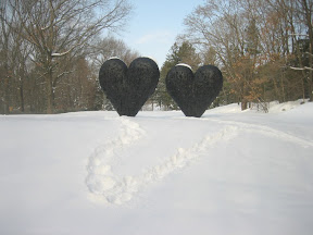
About halfway through the tour we skied through the deCordova sculpture museum grounds, thus the first image. The museum shop, open year round, has a nice space to take a break and eat a small snack. It was a perfect rest and allowed us to enjoy the remainder of the day on the trails.

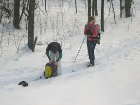
But far and away the best part of skiing in Lincoln is the scenery. The woods are spectacular, especially this time of the year.

And you even get to ski by the Gropius House.
To find such natural and manmade beauty so close to Boston is spectacular.

Skiing around Lincoln finally wore us out, we returned to Lincoln Center. We took the 2:42 train after picking up some hot chocolate and snacks for the ride home.
The MBTA runs eight trains each way on the weekend. The Fitchburg line schedule is what you want to check.
Once you exit the train in Lincoln, across the parking lot in front of you is a grocery store, perfect for picking up a second breakfast or trail snacks.
To find the ski trails, walk down the platform in the direction of Fitchburg and continue along the parking lot in the same direction, you will reach a lightly plowed road next to a playground. Follow this road - you may be able to ski on the road - at the end of the road you will reach a large field where the ski trails begin.
Someone with a good sense of direction could probably ski here for hours without getting lost, but I would recommend a map. A trail map is available at Town Offices, I bought mine at the town library.
Alternatively, you can use a USGS topo map; it doesn't have the trails, but it does have major buildings and roads. The correct map here is the Maynard map. This particular PDF map is also georeferenced, and can be used with the PDF Maps program on an iPhone, which will both show the map on the screen and plot your GPS location on the map, making navigation fun and simple.
Enjoy skiing in Lincoln, and let me know how your trip goes.
And just for fun, here is a short, first-person video of me skiing down a short hill in Lincoln.


I made a similar ski exploration of the Walden Pond/Sudbury River area. I navigated with OpenStreetMap via Maverick on my Android phone; worked very well. It really is an excellent place with lots of easy to link trails.
ReplyDelete